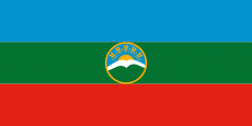
Karachay-Cherkessia (Karachayevo-Cherkesiya)
 |
 |
Karachay-Cherkessia is one of Russia's ethnic republics, primarily representing the indigenous Caucasian-Turkic Karachay people and the Cherkess or Circassian people. Karachays form the largest ethnic group at around 44% of the population, followed by ethnic Russians (27%) and Cherkess (13%). The Cherkess are mostly of the Besleney and Kabardin tribes. The republic has five official languages: Russian, Abaza, Cherkess (Kabardian), Karachay-Balkar, and Nogai.
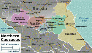
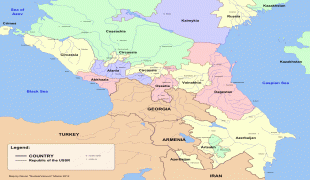
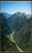
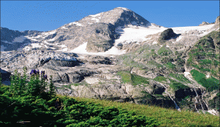
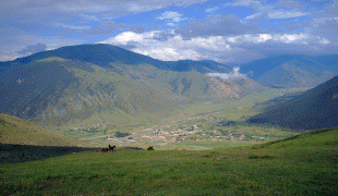
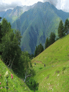
The majority of the republic's territory is within the Caucasus Mountains, except for a small strip at the northern edge of the Don Steppe. Karachay-Cherkessia is bordered by Krasnodar Krai to the west, Stavropol Krai to the north-east, Kabardino-Balkaria to the south-east, and an international border with Georgia to the south-west. Mount Elbrus, the highest mountain in Europe, is located on the border with Kabardino-Balkaria.
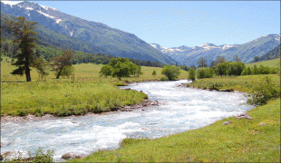
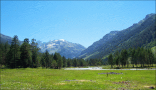
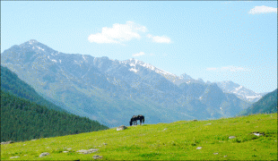
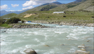
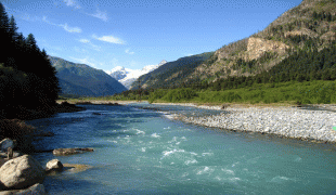
The republic is located at the slopes of northwestern Caucasus and borders with Krasnodar Krai in the west and northwest, the Kabardino-Balkar Republic in the southeast, Georgia (including Abkhazia) in the south and west, and with Stavropol Krai in the northeast. It stretches for 140 km from north to south and for 170 km from east to west. Mountains cover 80% of the republic's territory; Mount Elbrus, which at 5642 m is the highest peak in the Caucasus, is located on the republic's border with Kabardino-Balkaria. The republic is rich in water resources. A total of 172 rivers flow through its territory, with the largest one being the Kuban, Bolshoy Zelenchuk, Maly Zelenchuk, Urup, and Laba. There are about 130 mountain lakes of glacial origin and an abundance of mineral springs. Climate is moderate, with short winters and long, warm, humid summers. The average January temperature is -3.2 C, and the average July temperature is +20.6 C. Average annual precipitation varies from 550 mm in the plains to 2500 mm in the mountains. Natural resources include gold, coal, clays, and more.
Map - Karachay-Cherkessia (Karachayevo-Cherkesiya)
Map


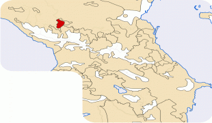

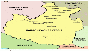


Country - Russia
 |
 |
| Flag of Russia | |
The East Slavs emerged as a recognisable group in Europe between the 3rd and 8th centuries CE. The first East Slavic state, Kievan Rus', arose in the 9th century, and in 988, it adopted Orthodox Christianity from the Byzantine Empire. Rus' ultimately disintegrated, with the Grand Duchy of Moscow growing to become the Tsardom of Russia. By the early 18th century, Russia had vastly expanded through conquest, annexation, and the efforts of Russian explorers, developing into the Russian Empire, which remains the third-largest empire in history. However, with the Russian Revolution in 1917, Russia's monarchic rule was abolished and replaced by the Russian SFSR—the world's first constitutionally socialist state. Following the Russian Civil War, the Russian SFSR established the Soviet Union (with three other Soviet republics), within which it was the largest and principal constituent. At the expense of millions of lives, the Soviet Union underwent rapid industrialization in the 1930s, and later played a decisive role for the Allies of World War II by leading large-scale efforts on the Eastern Front. With the onset of the Cold War, it competed with the United States for global ideological influence; the Soviet era of the 20th century saw some of the most significant Russian technological achievements, including the first human-made satellite and the first human expedition into outer space.
Currency / Language
| ISO | Currency | Symbol | Significant figures |
|---|---|---|---|
| RUB | Russian ruble | ₽ | 2 |
| ISO | Language |
|---|---|
| CE | Chechen language |
| CV | Chuvash language |
| KV | Komi language |
| RU | Russian language |
| TT | Tatar language |
