Juana Azurduy de Padilla International Airport (Juana Azurduy de Padilla International Airport (historical))
Juana Azurduy de Padilla International Airport is an airport located in Sucre, Bolivia, the nation's constitutional capital city. It is currently a base of the Bolivian Air Force and was formerly Sucre's main commercial airport until it was replaced by the Alcantarí Airport.
The only runway at Juana Azurduy de Padilla is 9,400 ft in length, and at an altitude of 9528 ft. Because of this high altitude, many people who arrived at Sucre via rapid air travel get altitude sickness. The altitude also caused the airport to be excessively cloudy at times, making approach difficult.
As with many in Latin America, Juana Azurduy de Padilla International Airport was not open 24 hours a day. It was only open from sunrise to sunset.
Though Sucre is Bolivia's constitutional (de jure) capital city, Juana Azurduy de Padilla International Airport was not the largest airport in the country. The largest airport is Viru Viru in Santa Cruz de la Sierra.
The airport was named after Juana Azurduy de Padilla, who fought for the independence against Spain.
On May 15, 2016, after 41 years of service, the Juana Azurduy de Padilla International Airport ended its commercial flight service, and all its operations moved to Alcantarí Airport. On 2017, the administration of the airport passed from AASANA to the military, turning the airport into an air force base.
Map - Juana Azurduy de Padilla International Airport (Juana Azurduy de Padilla International Airport (historical))
Map
Country - Bolivia
 |
 |
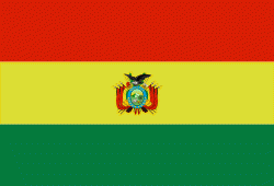
| Flag of Bolivia | |
The sovereign state of Bolivia is a constitutionally unitary state, divided into nine departments. Its geography varies from the peaks of the Andes in the West, to the Eastern Lowlands, situated within the Amazon basin. One-third of the country is within the Andean mountain range. With 1098581 km2 of area, Bolivia is the fifth largest country in South America, after Brazil, Argentina, Peru, and Colombia (and alongside Paraguay, one of the only two landlocked countries in the Americas), the 27th largest in the world, the largest landlocked country in the Southern Hemisphere, and the world's seventh largest landlocked country, after Kazakhstan, Mongolia, Chad, Niger, Mali, and Ethiopia.
Currency / Language
| ISO | Currency | Symbol | Significant figures |
|---|---|---|---|
| BOB | Boliviano | Bs | 2 |
| ISO | Language |
|---|---|
| AY | Aymara language |
| QU | Quechua language |
| ES | Spanish language |


