Wotje Atoll (Wotje Atoll)
Wotje Atoll (Marshallese: Wōjjā, ) is a coral atoll of 75 islands in the Pacific Ocean, and forms a legislative district of the Ratak Chain of the Marshall Islands.
Wotje's land area of 8.18 km2 is one of the largest in the Marshall Islands, and encloses a lagoon of 624 km2. The atoll is oriented east and west and is 45 km at its longest point, and 18 km at its greatest width. , the population was nearly 1,000, which included about 200 teenagers who live on the island at the public boarding school, Northern Islands High School. In 2011, the resident population of the islands in atoll was 859. The Wotje Atoll includes a number of islets, including Wotje (the largest), Bodao, Enejeltalk, Ukon, Wetwirok, Kaiken, Wormej, Kimajo, Ninum, Kaben. About 125 people live on Wodmej, which is approximately 8 miles from the main island of Wotje. All other islands are uninhabited and are used only for copra production, picnics, and food gathering.
Wotje's land area of 8.18 km2 is one of the largest in the Marshall Islands, and encloses a lagoon of 624 km2. The atoll is oriented east and west and is 45 km at its longest point, and 18 km at its greatest width. , the population was nearly 1,000, which included about 200 teenagers who live on the island at the public boarding school, Northern Islands High School. In 2011, the resident population of the islands in atoll was 859. The Wotje Atoll includes a number of islets, including Wotje (the largest), Bodao, Enejeltalk, Ukon, Wetwirok, Kaiken, Wormej, Kimajo, Ninum, Kaben. About 125 people live on Wodmej, which is approximately 8 miles from the main island of Wotje. All other islands are uninhabited and are used only for copra production, picnics, and food gathering.
Map - Wotje Atoll (Wotje Atoll)
Map


Country - Marshall_Islands
 |
 |
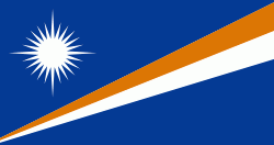
| Flag of the Marshall Islands | |
The country's population of 42,050 people (at the 2021 World Bank Census ) is spread out over five islands and 29 coral atolls, comprising 1,156 individual islands and islets. The capital and largest city is Majuro. It has the largest portion of its territory composed of water of any sovereign state, at 97.87%. The islands share maritime boundaries with Wake Island to the north, Kiribati to the southeast, Nauru to the south, and the Federated States of Micronesia to the west. About 52.3% of Marshall Islanders (27,797 at the 2011 Census) live on Majuro. In 2016, 73.3% of the population were defined as being "urban". The UN also indicates a population density of 295 PD/km2, and its projected 2020 population is 59,190.
Currency / Language
| ISO | Currency | Symbol | Significant figures |
|---|---|---|---|
| USD | United States dollar | $ | 2 |
| ISO | Language |
|---|---|
| EN | English language |
| MH | Marshallese language |