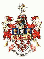
Warrington
 |
The population in 2019 was estimated at 165,456 for the town's urban area, and 210,014 for the wider borough, the latter being more than double that of 1968 when it became a new town. Warrington is the largest town in the ceremonial county of Cheshire. In 2011 the unparished area had a population of 58,871.
Warrington was founded by the Romans at an important crossing place on the River Mersey. A new settlement was established by the Saxon Wærings. By the Middle Ages, Warrington had emerged as a market town at the lowest bridging point of the river. A local tradition of textile and tool production dates from this time.
The expansion and urbanisation of Warrington coincided with the Industrial Revolution, particularly after the Mersey was made navigable in the 18th century. The West Coast Main Line runs north to south through the town, and the Liverpool to Manchester railway (the Cheshire Lines route) west to east. The Manchester Ship Canal cuts through the south of the borough (west to east). The M6, M56 and M62 motorways form a partial box around the town and are all accessible through Warrington.
The modern Borough of Warrington was formed in 1974 with the amalgamation of the former County Borough of Warrington, part of the Golborne Urban District, the Lymm Urban District, part of the Runcorn Rural District, the Warrington Rural District and part of the Whiston Rural District.
The earliest known appearance of the name is ‘’Weringtun’', when before the Norman Conquest it was the head of a hundred. An entry in the Domesday Book in AD 1086 named it as ‘’Wallintun‘’. The root is likely the Old English word waru – meaning "those that care for, watch, guard, protect, or defend.” The suffix -ing is a cognate of inge, an ethnonym for the Ingaevones said variously to mean "of Yngvi," "family, people or followers of" or a genitive plural form of an inhabitant appellation. The suffix "ton" is from the Old English word tun meaning "fenced area" or "enclosure."
Map - Warrington
Map
Country - United_Kingdom
 |
 |
| Flag of the United Kingdom | |
The United Kingdom has evolved from a series of annexations, unions and separations of constituent countries over several hundred years. The Treaty of Union between the Kingdom of England (which included Wales, annexed in 1542) and the Kingdom of Scotland in 1707 formed the Kingdom of Great Britain. Its union in 1801 with the Kingdom of Ireland created the United Kingdom of Great Britain and Ireland. Most of Ireland seceded from the UK in 1922, leaving the present United Kingdom of Great Britain and Northern Ireland, which formally adopted that name in 1927. The nearby Isle of Man, Guernsey and Jersey are not part of the UK, being Crown Dependencies with the British Government responsible for defence and international representation. There are also 14 British Overseas Territories, the last remnants of the British Empire which, at its height in the 1920s, encompassed almost a quarter of the world's landmass and a third of the world's population, and was the largest empire in history. British influence can be observed in the language, culture and the legal and political systems of many of its former colonies.
Currency / Language
| ISO | Currency | Symbol | Significant figures |
|---|---|---|---|
| GBP | Pound sterling | £ | 2 |
| ISO | Language |
|---|---|
| EN | English language |
| GD | Gaelic language |
| CY | Welsh language |


