Map - Wadowice County (Powiat wadowicki)

Wadowice County (Powiat wadowicki)
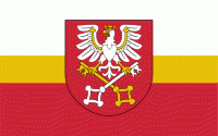
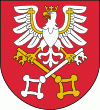
Wadowice County (powiat wadowicki) is a unit of territorial administration and local government (powiat) in Lesser Poland Voivodeship, southern Poland. It came into being on January 1, 1999, as a result of the Polish local government reforms passed in 1998. Its administrative seat is the town of Wadowice, the birthplace of Pope John Paul II, which lies 38 km south-west of the regional capital Kraków. The county also contains the towns of Andrychów, lying 13 km west of Wadowice, and Kalwaria Zebrzydowska, 14 km east of Wadowice.

The county covers an area of 645.74 km2. As of 2006 its total population is 154,304, out of which the population of Andrychów is 21,691, that of Wadowice is 19,149, that of Kalwaria Zebrzydowska is 4,503, and the rural population is 108,961.

Wadowice County is bordered by Chrzanów County to the north, Kraków County and Myślenice County to the east, Sucha County to the south, Żywiec County to the south-west, Bielsko County to the west, and Oświęcim County to the north-west.

 
Map - Wadowice County (Powiat wadowicki)
Map
Google Earth - Map - Wadowice County
Google Earth
Openstreetmap - Map - Wadowice County
Openstreetmap
Map - Wadowice County - Esri.WorldImagery
Esri.WorldImagery
Map - Wadowice County - Esri.WorldStreetMap
Esri.WorldStreetMap
Map - Wadowice County - OpenStreetMap.Mapnik
OpenStreetMap.Mapnik
Map - Wadowice County - OpenStreetMap.HOT
OpenStreetMap.HOT
Map - Wadowice County - CartoDB.Positron
CartoDB.Positron
Map - Wadowice County - CartoDB.Voyager
CartoDB.Voyager
Map - Wadowice County - OpenMapSurfer.Roads
OpenMapSurfer.Roads
Map - Wadowice County - Esri.WorldTopoMap
Esri.WorldTopoMap
Map - Wadowice County - Stamen.TonerLite
Stamen.TonerLite
Country - Poland
Flag of Poland
Poland, officially the Republic of Poland, is a country in Central Europe. It is divided into 16 administrative provinces called voivodeships, covering an area of 312696 km2. Poland has a population of 37.7 million and is the fifth-most populous member state of the European Union. Warsaw is the nation's capital and largest metropolis. Other major cities include Kraków, Wrocław, Łódź, Poznań, Gdańsk, and Szczecin.

Poland has a temperate transitional climate and its territory traverses the Central European Plain, extending from Baltic Sea in the north to Sudeten and Carpathian Mountains in the south. The longest Polish river is the Vistula, and Poland's highest point is Mount Rysy, situated in the Tatra mountain range of the Carpathians. The country is bordered by Lithuania and Russia to the northeast, Belarus and Ukraine to the east, Slovakia and the Czech Republic to the south, and Germany to the west. It also shares maritime boundaries with Denmark and Sweden.
Currency / Language  
ISO Currency Symbol Significant figures
PLN Polish złoty zÅ‚ 2
ISO Language
PL Polish language
Neighbourhood - Country  
  •  Belarus 
  •  Czech Republic 
  •  Germany 
  •  Lithuanian Soviet Socialist Republic 
  •  Russia 
  •  Slovakia 
  •  Ukraine 
Administrative Subdivision
Country, State, Region,...