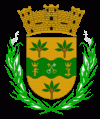
Toa Baja (Toa Baja Municipio)
 |
 |
The region of what is now Toa Baja belonged to the Taíno region of Toa and Bayamón, which was located on the north coast of Puerto Rico. The regions were led by cacique Aramana and Majagua respectively. During the Spanish colonization, a farm was settled in the region around 1511 where Spanish settlers tried to learn from the Taínos how to grow fruits and vegetables. Some of the families who settled in the region were Marrero, Salgado, and Martínez, from the Canary Islands.
In 1745, the town was officially organized, with the parish being built in 1749. It was dedicated to Nuestra Señora de la Concepción (Our Lady of the Immaculate Conception). It is said that in 1776 there were six cattle ranches and 12 sugar cane estates in the region. However, rises in the flow of nearby rivers were problematic for the population. Because of this, in 1841 a group of residents requested the settlement to be transferred to what is now Dorado. The municipality of Dorado was officially founded the next year.
Puerto Rico was ceded by Spain in the aftermath of the Spanish–American War under the terms of the Treaty of Paris of 1898 and became a territory of the United States. In 1899, the United States conducted its first census of Puerto Rico, finding that the population of Toa Baja was 4,030.
In 1902, the Legislative Assembly of Puerto Rico approved the consolidation of several municipalities, which resulted in the annexation of Toa Baja to the municipality of Bayamón. However, in 1905 the law was annulled, and Toa Baja regained its status as an independent town.
In 2010, Toa Baja was among the top ten municipalities in Puerto Rico, in terms of population, with 89,609 residents.
The La Plata River rose more than 11 feet on September 20, 2017 as a result of Hurricane Maria and caused major infrastructure damage in Toa Baja.
The four radar systems used by the Federal Aviation Administration in Puerto Rico were broken and took almost two weeks to restore. One of the radar systems is located at Punta Salinas in Toa Baja.
Map - Toa Baja (Toa Baja Municipio)
Map
Country - Puerto Rico
 |
 |
Currency / Language
| ISO | Currency | Symbol | Significant figures |
|---|---|---|---|
| USD | United States dollar | $ | 2 |
| ISO | Language |
|---|---|
| EN | English language |
| ES | Spanish language |


