Tchaourou
Tchaourou (Saworo in Yoruba etymology, meaning rattle) is a commune, arrondissement, and city located in the Borgou Department of Benin, a country in Western Africa, formerly known as Dahomey (until 1975). It is the birthplace of former Beninese president Yayi Boni. It is 50 km south of Parakou.
The commune covers an area of 7256 km2 and as of 2013 had a population of 221,108 people., while the Tchaourou city proper has a population of 106,852 people, making it the 10th largest settlement in Benin.
The commune covers an area of 7256 km2 and as of 2013 had a population of 221,108 people., while the Tchaourou city proper has a population of 106,852 people, making it the 10th largest settlement in Benin.
Map - Tchaourou
Map


Country - Benin
 |
 |
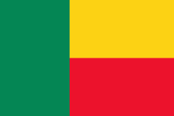
| Flag of Benin | |
From the 17th to the 19th century, political entities in the area included the Kingdom of Dahomey, the city-state of Porto-Novo, and other states to the north. This region was referred to as the Slave Coast from the early 17th century due to the high number of people who were sold and trafficked during the Atlantic slave trade to the New World. France took over the territory in 1894, incorporating it into French West Africa as French Dahomey. In 1960, Dahomey gained full independence from France. As a sovereign state, Benin has had democratic governments, military coups, and military governments. A self-described Marxist–Leninist state called the People's Republic of Benin existed between 1975 and 1990. In 1991, it was replaced by the multi-party Republic of Benin.
Currency / Language
| ISO | Currency | Symbol | Significant figures |
|---|---|---|---|
| XOF | West African CFA franc | Fr | 0 |
| ISO | Language |
|---|---|
| FR | French language |