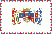
Szabolcs-Szatmár-Bereg County (Szabolcs-Szatmár-Bereg)
 |
 |
Szabolcs-Szatmár-Bereg County was organised after World War II from the previous counties Szatmár-Ugocsa-Bereg and Szabolcs. Before 1991, it was called Szabolcs-Szatmár County.
Szabolcs-Szatmár-Bereg is located in the north-eastern tip of Hungary. It borders Ukraine (Zakarpattia Oblast), Slovakia (Košice Region), and Romania (Bihor and Satu Mare counties), and has good connections both by road and rail. Within Hungary, the county is bordered by Borsod-Abaúj-Zemplén County and the Tisza River to the north-west and Hajdú-Bihar County to the south-west.
The early Hungarians transformed this region significantly by clearing large areas of forest to make way for pastures and farmland. Approximately 5 to 6 square kilometres of forest were cleared for the construction of the Szabolcs earthwork in the ninth and tenth centuries, and its ruins are still present. The area was the gateway for the Mongol invasion of Hungary in the 1240s, and suffered considerable destruction and population decrease during the raids. With the subsequent development of the country, the region became even more marginalized in the 15th century. Ongoing civil war, rebellion, and war exacted a heavy price and further hindered the region's development.
The county's borders have been altered frequently over the years, its current territory being established in 1950 with the amalgamation of the counties of Szabolcs-Ung and Szatmár-Bereg-Ugocsa.
There are many forests, fields, pastures, meadows, and moorland forests in the county. The bog moss moors at Csaroda, the Nyíres lake, and the Bábtava lake are especially valuable, as they contain many rare species of fauna and flora.
Szabolcs-Szatmár-Bereg is Hungary's sixth biggest county with a total land area of 5936 km2. From a geographical aspect, it is possible to divide the county into two main regions: The Upper Tisza Valley and the Nyírség. Tisza is one of the most important rivers of the county, entering Szabolcs-Szatmár-Bereg — and Hungary — at Tiszabecs, and leaving at Tiszadob. Its segment in Szabolcs-Szatmár-Bereg county is 235 kilometres long, out of which 208 km belongs to the Upper Tisza Valley, reaching the area of Tokaj and Rakamaz. The larger area named the Nyírség is derived from the word nyír meaning birch, as the region is dominated by birch woodlands. The northern part of Nyírség is covered with sandy forest soils, the southern areas have loose wind-blown sand. Alluvial and meadow soils are found in the Upper Tisza region.
The county has a continental climate; it is cooler than the Great Plain because it is further north. Summers are cooler than in other parts of the Plains. Annual precipitation is 550–600 millimetres. The higher than average number of days of sunshine make ideal conditions for the growing of tomatoes, sunflower, tobacco, apples, and other fruits such as plums—for which the county is famous, being eaten fresh, dried into prunes (some made into lekvar) and fermented into well-known brandies.
The county has 229 settlements, of which 20 are towns. The county capital and largest city is Nyíregyháza with a population of 116,900 in 2003. The other cities have relatively small populations, only those of Kisvárda and Mátészalka having around 18,000 inhabitants. The eastern part of the county is lightly populated and is dotted with small villages which often have very poor economic conditions.
Map - Szabolcs-Szatmár-Bereg County (Szabolcs-Szatmár-Bereg)
Map


Country - Hungary
 |
 |
| Flag of Hungary | |
The territory of present-day Hungary has for centuries been a crossroads for various peoples, including Celts, Romans, Germanic tribes, Huns, West Slavs and the Avars. The foundation of the Hungarian state was established in the late 9th century AD with the conquest of the Carpathian Basin by Hungarian grand prince Árpád. His great-grandson Stephen I ascended the throne in 1000, converting his realm to a Christian kingdom. By the 12th century, Hungary became a regional power, reaching its cultural and political height in the 15th century. Following the Battle of Mohács in 1526, it was partially occupied by the Ottoman Empire (1541–1699). Hungary came under Habsburg rule at the turn of the 18th century, later joining with the Austrian Empire to form Austria-Hungary, a major power into the early 20th century.
Currency / Language
| ISO | Currency | Symbol | Significant figures |
|---|---|---|---|
| HUF | Hungarian forint | Ft | 2 |
| ISO | Language |
|---|---|
| HU | Hungarian language |


