Savé
Savè is a city in Benin, lying on the Cotonou-Parakou railway and the main north–south road. It is known for its local boulders, popular with climbers. "Savè" is from the historical Yoruba name Ṣábẹ̀ẹ́.
The commune covers an area of 2228 square kilometres and as of 2002 had a population of 67,753 people.
On the 30th of January 1894 there was a treaty for French protectorate status between Brigadier General Alfred-Amédée Dodds, the commander superior of French establishments in Benin and Oba Akenmu, King of the Confederation of Nago Tchabè. Subsequently in 1903, due to disagreements, the Oba (Onichabe) tried to shift the Anglo-French border delineation westwards from the Okpara river to the Weme river in order to integrate the Shabe territory beginning at the north of Tchatchou into the same colonial authority as that of the Oyo and the Egba to the east under British Nigeria. For this, the Oba was arrested and served a one year jail term. He was later deported to Porto-Novo in 1902-1911.
In 1922, a small building served as a chapel for the Protestant Methodist mission in "Anu Abata" located in front of the Royal Palace and then later on, the estate currently housing the Salem Temple of Savè donated by Oba Akenmu. In 1924 the first catholic missionaries arrived.
Map - Savé
Map
Country - Benin
 |
 |
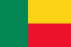
| Flag of Benin | |
From the 17th to the 19th century, political entities in the area included the Kingdom of Dahomey, the city-state of Porto-Novo, and other states to the north. This region was referred to as the Slave Coast from the early 17th century due to the high number of people who were sold and trafficked during the Atlantic slave trade to the New World. France took over the territory in 1894, incorporating it into French West Africa as French Dahomey. In 1960, Dahomey gained full independence from France. As a sovereign state, Benin has had democratic governments, military coups, and military governments. A self-described Marxist–Leninist state called the People's Republic of Benin existed between 1975 and 1990. In 1991, it was replaced by the multi-party Republic of Benin.
Currency / Language
| ISO | Currency | Symbol | Significant figures |
|---|---|---|---|
| XOF | West African CFA franc | Fr | 0 |
| ISO | Language |
|---|---|
| FR | French language |


