San Ignacio (San Ignacio)
San Ignacio and Santa Elena are towns in western Belize. San Ignacio serves as the cultural-economic hub of Cayo District. It got its start from mahogany and chicle production during British colonisation. Over time it attracted people from the surrounding areas, which led to the diverse population of the town today. San Ignacio is the largest settlement in Cayo District and the second largest in the country, after Belize City.
The town was originally named El Cayo by the Spanish. On 19 October 1904, El Cayo was officially declared a town by the government of British Honduras. In the past a creek ran between the Macal and the Mopan rivers one mile outside of San Ignacio going toward Benque Viejo. This creek then fulfilled the definition of an area of land completely surrounded by water and thus the name Cayo, "island". There was a large wooden bridge across this creek in the late 1940s, but since the creek eventually dried up, the area was filled with limestone gravel and today there remains no evidence of its existence. The demise of the creek, however, took away the distinction for the classification of a 'cayo' from the venerable western town of 'El Cayo' and returned it to a regular land mass.
The town was originally named El Cayo by the Spanish. On 19 October 1904, El Cayo was officially declared a town by the government of British Honduras. In the past a creek ran between the Macal and the Mopan rivers one mile outside of San Ignacio going toward Benque Viejo. This creek then fulfilled the definition of an area of land completely surrounded by water and thus the name Cayo, "island". There was a large wooden bridge across this creek in the late 1940s, but since the creek eventually dried up, the area was filled with limestone gravel and today there remains no evidence of its existence. The demise of the creek, however, took away the distinction for the classification of a 'cayo' from the venerable western town of 'El Cayo' and returned it to a regular land mass.
Map - San Ignacio (San Ignacio)
Map


Country - Belize
 |
 |
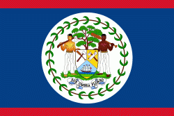
| Flag of Belize | |
The Maya civilization spread into the area of Belize between 1500 BC and AD 300 and flourished until about 1200. European contact began in 1492 when Christopher Columbus sailed along the Gulf of Honduras. European exploration was begun by English settlers in 1638. Spain and Britain both laid claim to the land until Britain defeated the Spanish in the Battle of St. George's Caye (1798). In 1840 it became a British colony known as British Honduras, and a Crown colony in 1862. Belize achieved its independence from the United Kingdom on 21 September 1981. It is the only mainland Central American country which is a Commonwealth realm, with King Charles III as its monarch and head of state, represented by a governor-general.
Currency / Language
| ISO | Currency | Symbol | Significant figures |
|---|---|---|---|
| BZD | Belize dollar | $ | 2 |
| ISO | Language |
|---|---|
| EN | English language |
| ES | Spanish language |