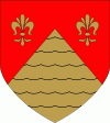
Saltvik
 |
The archipelago north of Saltvik is perhaps the most beautiful one in Åland. Closest to land are the big islands Boxö, Sommarö, Flatö and Ryssö. Beyond, the horizon opens up and after passing Saggö it is more or less unbroken.
The municipality has a rich history. When Åland emerged from the sea about 8,000 BC, Saltvik was the first land to be seen. During the Viking ages, Kvarnbo used to be a central crown court- and place of merchandise. Today, people can visit the medieval church and at the court place see the memorial monument.
The church St:a Maria is located by Kvarnboviken in the east of Saltvik. The red granite church is one of the oldest in Åland, and was once the main church in the province. The church has been rebuilt and extended several times. The oldest parts are from the late 13th century, but various reconstructions have been made from the 14th century until today. For example, the chalk drawings on the walls have first been painted, then covered and then uncovered again. Around and under the church, there are traces of houses from Viking Age. This is not so strange, considering the church is located in the middle of the biggest grave field from Iron Age in Åland.
A former Finnish government lands official claims a 17,800-square-meter (0.004 acre) plot on the island of Saltvik "had been handed over to Russia's Foreign Ministry in 2009, in accordance with a 1947 post-war peace treaty that saw German holdings in Finland transferred to the Soviet Union".
Map - Saltvik
Map


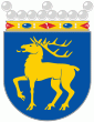
Country - Åland_Islands
 |
 |
Åland is situated in an archipelago, called the Åland Islands, at the entrance to the Gulf of Bothnia in the Baltic Sea belonging to Finland. It comprises Fasta Åland on which 90% of the population resides and about 6,500 skerries and islands to its east. Of Åland's thousands of islands, about 60–80 are inhabited. Fasta Åland is separated from the coast of Roslagen in Sweden by 38 km of open water to the west. In the east, the Åland archipelago is contiguous with the Finnish archipelago. Åland's only land border is located on the uninhabited skerry of Märket, which it shares with Sweden. From Mariehamn, there is a ferry distance of about 160 km to Turku, a coastal city of mainland Finland, and also to Stockholm, the capital of Sweden.
Currency / Language
| ISO | Currency | Symbol | Significant figures |
|---|---|---|---|
| EUR | Euro | € | 2 |
| ISO | Language |
|---|---|
| SV | Swedish language |
