Rum Cay (Rum Cay)
Rum Cay (formerly known as Mamana and Santa Maria de la Concepción) is an island and district of the Bahamas. It measures 30 sqmi in area, it is located at Lat.: N23 42' 30" - Long.: W 74 50' 00". It has many rolling hills that rise to about 120 feet (37 m).
The island is believed to have acquired its modern name from a shipwrecked cargo of rum. The main settlement is Port Nelson. Its population was recorded as 99 and as 30. Before 1996 the island was part of a combined district of San Salvador and Rum Cay. The population of Rum Cay as of 2015 is 53.
Rum Cay is 20 miles (32 km) southwest of San Salvador Island.
Map - Rum Cay (Rum Cay)
Map


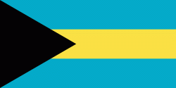
Country - The_Bahamas
 |
 |
The Bahama Islands were inhabited by the Lucayans, a branch of the Arawakan-speaking Taíno, for many centuries. Christopher Columbus was the first European to see the islands, making his first landfall in the "New World" in 1492 when he landed on the island of San Salvador. Later, the Spanish shipped the native Lucayans to and enslaved them on Hispaniola, after which the Bahama islands were mostly deserted from 1513 until 1648, nearly all native Bahamians having been forcibly removed for enslavement or having died of diseases that Europeans brought to the islands. In 1649, English colonists from Bermuda, known as the Eleutheran Adventurers, settled on the island of Eleuthera.
Currency / Language
| ISO | Currency | Symbol | Significant figures |
|---|---|---|---|
| BSD | Bahamian dollar | $ | 2 |
| ISO | Language |
|---|---|
| EN | English language |