Port Elizabeth (Port Elizabeth)
Gqeberha, also known by its former name Port Elizabeth and widely referred to as P.E., is a major seaport and the most populous city in the Eastern Cape province of South Africa. It is the seat of the Nelson Mandela Bay Metropolitan Municipality, South Africa's second-smallest metropolitan municipality by area. It is the sixth-most populous city in South Africa and is the cultural, economic and financial centre of the Eastern Cape.
The city was founded as Port Elizabeth in 1820 by Sir Rufane Donkin, who was the governor of the Cape at the time. He named it after his late wife, Elizabeth, who had died in India. The Donkin memorial in the CBD of the city bears testament to this. It was established by the government of the Cape Colony when 4,000 British colonists settled in Algoa Bay to strengthen the border region between the Cape Colony and the Xhosa. It is nicknamed "The Friendly City" or "The Windy City". In 2019, the Eastern Cape Geographical Names Committee recommended that Port Elizabeth be renamed Gqeberha, after the Xhosa and Southern Khoe name for the Baakens River that flows through the city. The city's name change was officially gazetted on 23 February 2021, although the new name remained poorly used locally as of 2022.
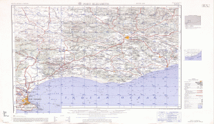
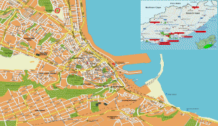
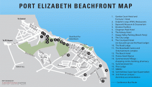
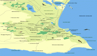
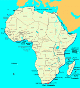
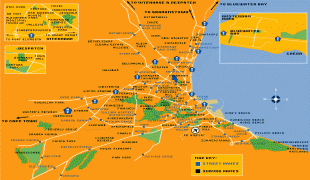
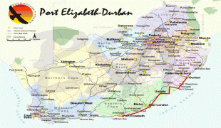
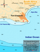
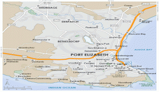
Located on the western portion of Algoa Bay along the southeastern coast of South Africa, the city lies 770 km east of Cape Town. It is east of the Garden Route and faces the Indian Ocean. It covers 251 square kilometers of the Nelson Mandela Bay metropolitan area, South Africa's sixth-largest metropolitan municipality. The city's warm oceanic climate ranks it among the top cities in the world for pleasant year-round weather. The city is known for many blue-flag beaches along the city's urban coastline; its popularity as an international and local holiday destination; and its rich and diverse cultural heritage. It is a gateway city for the Eastern Cape's adventure, outdoor and African big five game safari tourism.
In 1820, the rising seaport of Algoa Bay was named "Port Elizabeth" in memory of Elizabeth Frances née Markham, the late wife of Rufane Shaw Donkin, acting Governor of the Cape Colony. Colonists also called the settlement "The Bay". The settlement is also known by Xhosa speakers as "iBhayi" or "eBhayi", a Xhosa adaptation of the Afrikaans name "die Baai", meaning "the bay".
Gqeberha, the city's official name since 23 February 2021, is a Xhosa word used to refer to the Baakens river, which flows through the city.
The city was founded as Port Elizabeth in 1820 by Sir Rufane Donkin, who was the governor of the Cape at the time. He named it after his late wife, Elizabeth, who had died in India. The Donkin memorial in the CBD of the city bears testament to this. It was established by the government of the Cape Colony when 4,000 British colonists settled in Algoa Bay to strengthen the border region between the Cape Colony and the Xhosa. It is nicknamed "The Friendly City" or "The Windy City". In 2019, the Eastern Cape Geographical Names Committee recommended that Port Elizabeth be renamed Gqeberha, after the Xhosa and Southern Khoe name for the Baakens River that flows through the city. The city's name change was officially gazetted on 23 February 2021, although the new name remained poorly used locally as of 2022.
Located on the western portion of Algoa Bay along the southeastern coast of South Africa, the city lies 770 km east of Cape Town. It is east of the Garden Route and faces the Indian Ocean. It covers 251 square kilometers of the Nelson Mandela Bay metropolitan area, South Africa's sixth-largest metropolitan municipality. The city's warm oceanic climate ranks it among the top cities in the world for pleasant year-round weather. The city is known for many blue-flag beaches along the city's urban coastline; its popularity as an international and local holiday destination; and its rich and diverse cultural heritage. It is a gateway city for the Eastern Cape's adventure, outdoor and African big five game safari tourism.
In 1820, the rising seaport of Algoa Bay was named "Port Elizabeth" in memory of Elizabeth Frances née Markham, the late wife of Rufane Shaw Donkin, acting Governor of the Cape Colony. Colonists also called the settlement "The Bay". The settlement is also known by Xhosa speakers as "iBhayi" or "eBhayi", a Xhosa adaptation of the Afrikaans name "die Baai", meaning "the bay".
Gqeberha, the city's official name since 23 February 2021, is a Xhosa word used to refer to the Baakens river, which flows through the city.
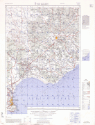
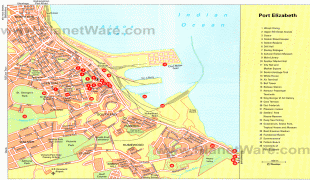
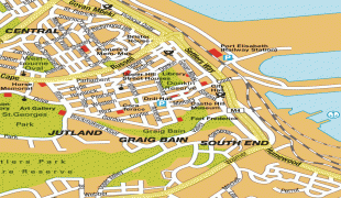
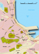
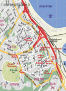
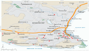
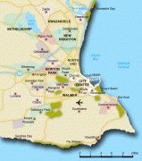
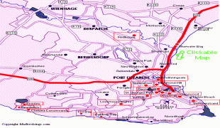
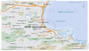
Map - Port Elizabeth (Port Elizabeth)
Map


Country - South_Africa
 |
 |
| Flag of South Africa | |
About 80% of the population are Black South Africans. The remaining population consists of Africa's largest communities of European (White South Africans), Asian (Indian South Africans and Chinese South Africans), and multiracial (Coloured South Africans) ancestry. South Africa is a multiethnic society encompassing a wide variety of cultures, languages, and religions. Its pluralistic makeup is reflected in the constitution's recognition of 11 official languages, the fourth-highest number in the world. According to the 2011 census, the two most spoken first languages are Zulu (22.7%) and Xhosa (16.0%). The two next ones are of European origin: Afrikaans (13.5%) developed from Dutch and serves as the first language of most Coloured and White South Africans; English (9.6%) reflects the legacy of British colonialism and is commonly used in public and commercial life.
Currency / Language
| ISO | Currency | Symbol | Significant figures |
|---|---|---|---|
| ZAR | South African rand | Rs | 2 |
| ISO | Language |
|---|---|
| AF | Afrikaans language |
| EN | English language |
| ST | Sotho language |
| SS | Swati language |
| TS | Tsonga language |
| TN | Tswana language |
| VE | Venda language |
| XH | Xhosa language |
| ZU | Zulu language |