Piarco International Airport (Piarco International Airport)
Piarco International Airport is an international airport serving the island of Trinidad and is one of two international airports in Trinidad and Tobago. The airport is located 30 km east of Downtown Port of Spain, located in the adjacent town of Piarco. The airport is the primary hub and operating base for the country's national airline, as well as the Caribbean's largest airline, Caribbean Airlines.
Piarco International Airport has direct scheduled service to destinations in the United States, Canada, Central America, South America and Europe. It is also a significant transit hub for the Southern Caribbean and serves as the primary connection point for many passengers travelling from Guyana.
The Piarco Airport opened on 8 January 1931, to serve Venezuela's Compagnie Generale Aeropostale. Before this, the Queen's Park Savannah, the Mucurapo Field, and the Cocorite Docks (for flying boats) were used as airstrips to serve the island.
In World War II the original airfield was used by the Royal Navy for the Fleet Air Arm No. 1 Observer Training School with the base known as RNAS Piarco (HMS Goshawk). The following squadrons were based there until disbanding in 1945:
* 749 Naval Air Squadron (Observer Training Squadron), 1 January 1941 - 1 October 1945
* 750 Naval Air Squadron (Observer Training Squadron), 5 November 1940 - 10 October 1945
* 752 Naval Air Squadron (Observer Training Squadron), 5 November 1940 - 9 November 1945
* 793 Naval Air Squadron (Air Towed Target Unit), 18 November 1940 - 10 October 1945
* 817 Naval Air Squadron (Torpedo, Spotter, Reconnaissance Squadron), 'Z' flight, 21 September 1943 - 27 September 1943.
In 1942 it was also used by both the United States Army Air Forces Sixth Air Force and United States Navy air squadrons. The airport was used both as a transport airfield and also for anti submarine patrol flights over the south Caribbean. It was returned to civil control after the war ended.
| IATA Code | POS | ICAO Code | TTPP | FAA Code | |
|---|---|---|---|---|---|
| Telephone | Fax | ||||
| Home page | Hyperlink |
Map - Piarco International Airport (Piarco International Airport)
Map
Country - Trinidad_and_Tobago
 |
 |
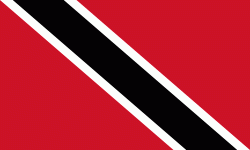
| Flag of Trinidad and Tobago | |
The island of Trinidad was inhabited for centuries by Indigenous peoples before becoming a colony in the Spanish Empire, following the arrival of Christopher Columbus, in 1498. Spanish governor José María Chacón surrendered the island to a British fleet under the command of Sir Ralph Abercromby in 1797. Trinidad and Tobago were ceded to Britain in 1802 under the Treaty of Amiens as separate states and unified in 1889. Trinidad and Tobago obtained independence in 1962, becoming a republic in 1976.
Currency / Language
| ISO | Currency | Symbol | Significant figures |
|---|---|---|---|
| TTD | Trinidad and Tobago dollar | $ | 2 |
| ISO | Language |
|---|---|
| ZH | Chinese language |
| EN | English language |
| FR | French language |
| ES | Spanish language |


