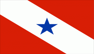
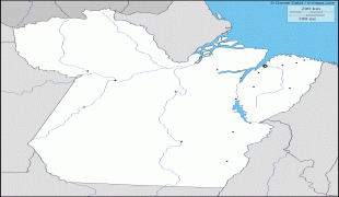
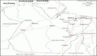
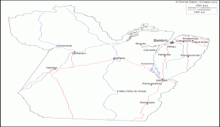
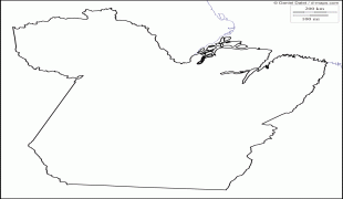
Map - Pará

Pará
Pará is a state of Brazil, located in northern Brazil and traversed by the lower Amazon River. It borders the Brazilian states of Amapá, Maranhão, Tocantins, Mato Grosso, Amazonas and Roraima. To the northwest are the borders of Guyana and Suriname, to the northeast of Pará is the Atlantic Ocean. The capital and largest city is Belém, which is located at the Marajó bay, near the estuary of the Amazon river. The state, which is home to 4.1% of the Brazilian population, is responsible for just 2.2% of the Brazilian GDP.

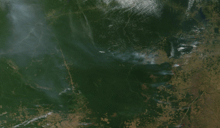
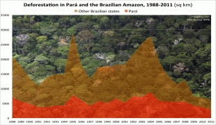
Pará is the most populous state of the North Region, with a population of over 8.6 million, being the ninth-most populous state in Brazil. It is the second-largest state of Brazil in area, at 1.2 e6km2, second only to Amazonas upriver. Its most famous icons are the Amazon River and the Amazon Rainforest. Pará produces rubber (extracted from natural rubber tree groves), cassava, açaí, pineapple, cocoa, black pepper, coconut, banana, tropical hardwoods such as mahogany, and minerals such as iron ore and bauxite. A new commodity crop is soy, cultivated in the region of Santarém.

Every October, Belém receives tens of thousands of tourists for the year's most important religious celebration: the procession of the Círio de Nazaré. Another important attraction of the capital is the Marajó-style ceramics, based on the extinct Marajoara culture, which developed on an island in the Amazon River.

The state's name is a toponym of the Tupi word pará – literally "sea", but sometimes used to refer to large rivers. The state was named after the river of the same name, the Pará River, one of the tributaries of the Amazon River.
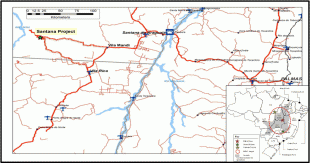
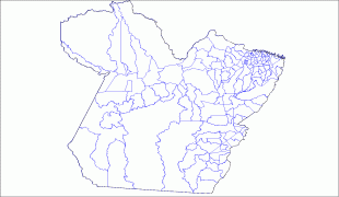
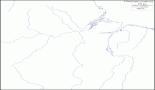
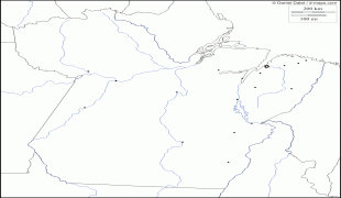
 
Map - Pará
Map
Google - Map - Pará
Google
Google Earth - Map - Pará
Google Earth
Nokia - Map - Pará
Nokia
Openstreetmap - Map - Pará
Openstreetmap
3868433507_8c2572371...
2816x2112
farm3.staticflickr.c...
Mapa-de-Carreteras-F...
2784x1928
mapas.owje.com
Para_State_Road_Map_...
2784x1928
www.zonu.com
0001-3765-aabc-aop71...
2835x1671
www.scielo.br
map_of_usa_with_stat...
2000x1237
hgeo67.files.wordpre...
20110912_C2240_PHOTO...
2000x1053
photos.newswire.ca
Satellite_Image_Phot...
1500x1142
www.zonu.com
Imagen-Foto-Satelite...
1500x1142
mapas.owje.com
11347259-political-m...
1200x1200
us.123rf.com
0408-deforestation-i...
1278x904
photos.mongabay.com
Para_Municipalities....
1257x848
upload.wikimedia.org
bandeira_para.jpg
1182x827
files.qrz.com
zacatecas-state-mexi...
879x1097
www.mapas-de-mexico....
united-states-map.jp...
1100x850
3.bp.blogspot.com
para23.gif
972x944
d-maps.com
para34.gif
972x944
d-maps.com
para56.gif
972x944
d-maps.com
para04.gif
972x944
d-maps.com
para06.gif
972x944
d-maps.com
para24.gif
972x944
d-maps.com
Country - Brazil
Currency / Language  
ISO Currency Symbol Significant figures
BRL Brazilian real R$ 2
Neighbourhood - Country  
  •  Argentina 
  •  Bolivia 
  •  Colombia 
  •  French Guiana 
  •  Guyana 
  •  Paraguay 
  •  Peru 
  •  Suriname 
  •  Uruguay 
  •  Venezuela 
Administrative Subdivision
Country, State, Region,...