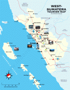
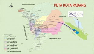
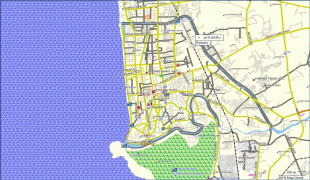
Padang
 |
The city had historically been a trading center since the pre-colonial era, trading in pepper and gold. The Dutch made contact with the city in the mid 17th century, eventually constructing a fortress and taking over control of the city from the Pagaruyung Kingdom. Save for several interruptions of British rule, Padang remained part of the Dutch East Indies as one of its major cities until Indonesian independence. In 1906, Padang along with Palembang became the first populated places in Sumatra to achieve city status (gemeente).
Padang has been a trade centre since the 16th century, having been controlled by the Pagaruyung Kingdom and the Aceh Sultanate. During the 16th and 17th centuries pepper was cultivated and traded with India, Portugal, the United Kingdom and the Netherlands. In 1663 the city came under the authority of the Dutch and a trading post was built in 1680. The city came under the British Empire twice, firstly from 1781 to 1784 during the Fourth Anglo-Dutch War, and again from 1795 to 1819 during the Napoleonic Wars. In 1819 the city was transferred back to the Netherlands. Up to circa 1780 the most important trade product was gold originating from gold mines in the region. When the mines were exhausted, the focus turned to other products such as coffee, salts and textiles.
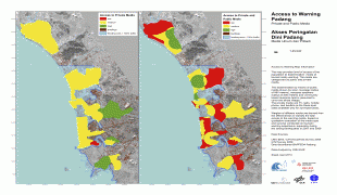
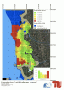
In 1797 Padang was inundated by a tsunami with an estimated flow depth of 5–10 metres, following an earthquake, estimated to be 8.5–8.7 Mw, which occurred off the coast. The shaking caused considerable damage and the deaths of two people, while the tsunami resulted in several houses being washed away and several deaths at the village of Air Manis. Boats moored in the Arau river ended up on dry land, including a 200-ton sailing ship which was deposited about 1 kilometre upstream. In 1833 another tsunami inundated Padang with an estimated flow depth of 3–4 metres as a result of an earthquake, estimated to be 8.6–8.9 Mw, which occurred off Bengkulu. The shaking caused considerable damage in Padang, and due to the tsunami boats moored in the Arau river broke their anchors and were scattered.
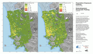
The population of Padang in 1920 was 28,754, the second largest city in Sumatra behind Palembang. At the time of independence in the 1940s the city had around 50,000 inhabitants. Coffee was still important, but copra was also a major item produced by farmers in its hinterland. The population growth since then has been partly a result of growth in the area of the city, but largely is a result of the migration to major cities seen in so many developing nations. From 1950 the Ombilin coal field developed with Padang as its outlet port. This was seen by some observers as reflecting the economic and political colonisation of Indonesia.
On 30 September 2009, a 7.9 magnitude earthquake hit about 50 kilometres off the coast of Padang. There were more than 1,100 fatalities, 313 of which occurred within Padang.
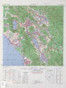
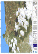
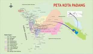
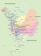
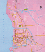
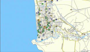
Map - Padang
Map


Country - Indonesia
 |
 |
| Flag of Indonesia | |
As the world's third largest democracy, Indonesia is a presidential republic with an elected legislature. It has 38 provinces, of which nine have special status. The country's capital, Jakarta, is the world's second-most populous urban area. Indonesia shares land borders with Papua New Guinea, East Timor, and the eastern part of Malaysia, as well as maritime borders with Singapore, Vietnam, Thailand, the Philippines, Australia, Palau, and India. Despite its large population and densely populated regions, Indonesia has vast areas of wilderness that support one of the world's highest level of biodiversity.
Currency / Language
| ISO | Currency | Symbol | Significant figures |
|---|---|---|---|
| IDR | Indonesian rupiah | Rp | 2 |
| ISO | Language |
|---|---|
| NL | Dutch language |
| EN | English language |
| ID | Indonesian language |
| JV | Javanese language |