Northern Province (Northern Province)
 |
 |
Parts of present-day Northern Province were part of the pre-colonial Jaffna kingdom. Other parts were ruled by Vanniar Chieftains who paid tribute to the Jaffna kingdom. The province then came under Portuguese, Dutch and British control. In 1815 the British gained control of the entire island of Ceylon. They divided the island into three ethnic based administrative structures: Low Country Sinhalese, Kandyan Sinhalese and Tamil. The Northern Province was part of the Tamil administration. In 1833, in accordance with the recommendations of the Colebrooke-Cameron Commission, the ethnic based administrative structures were unified into a single administration divided into five geographic provinces. The districts of Jaffna, Mannar, Nuvarakalaviya (present day Anuradhapura District) and Vanni formed the new Northern Province. Nuvarakalaviya was transferred to the newly created North Central Province in 1873.
The Indo-Lanka Accord signed on 29 July 1987 required the Sri Lankan government to devolve powers to the provinces and, in the interim, to merge the Northern and Eastern provinces into one administrative unit. The accord required a referendum to be held by 31 December 1988 in the Eastern Province to decide whether the merger should be permanent. Crucially, the accord allowed the Sri Lankan president to postpone the referendum at his discretion.
On 14 November 1987 the Sri Lankan Parliament passed the 13th Amendment to the 1978 Constitution of Sri Lanka and the Provincial Councils Act No 42 of 1987, establishing provincial councils. On September 2 and 8 1988 President Jayewardene issued proclamations enabling the Northern and Eastern provinces to be one administrative unit administered by one elected Council. The North-East Province was born.
The proclamations were only meant to be a temporary measure until a referendum was held in the Eastern Province on a permanent merger between the two provinces. However, the referendum was never held and successive Sri Lankan presidents issued proclamations annually extending the life of the "temporary" entity.
The merger was bitterly opposed by Sri Lankans. The combined North-East Province occupied one fourth of Sri Lanka. The thought of the rebel Liberation Tigers of Tamil Eelam controlling this province, directly or indirectly, alarmed them greatly. On 14 July 2006, after a long campaign against the merger, the Janatha Vimukthi Peramuna political party filed three separate petitions with the Supreme Court requesting a separate provincial council for the East. On 16 October 2006 the Supreme Court ruled that the proclamations issued by President Jayewardene were null and void and had no legal effect. The North-East Province was formally de-merged into the Northern and Eastern provinces on 1 January 2007.
Much of the Northern Province was under the control of rebel Liberation Tigers of Tamil Eelam for many years during the civil war. The entire province was recaptured by the Sri Lankan military in 2009.
While the Northern province has seen an era of peace after the end of the war the scars left by the war still remain. Despite the large amount of infrastructure projects undertaken by the Rajapaksa government at the cost of over $3 Billion the projects have been unable to create new jobs and as a result the province is suffering from extreme levels on unemployment.
In late 2014, former President of Sri Lanka Mahinda Rajapaksa imposed a travel ban to prevent foreigners from traveling to the former war zone in the province. This ban was lifted three months later by the newly elected president Maithripala Sirisena.
Due to its large Tamil population, the Northern Province is sometimes referred to as Sri Lanka's Tamil country.
Map - Northern Province (Northern Province)
Map
Country - Sri_Lanka
 |
 |
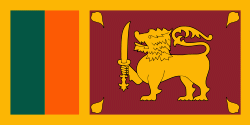
| Flag of Sri Lanka | |
Sri Lanka has a population of around 22 million (2020) and is a multinational state, home to diverse cultures, languages, and ethnicities. The Sinhalese are the majority of the nation's population. The Tamils, who are a large minority group, have also played an influential role in the island's history. Other long established groups include the Moors, the Burghers, the Malays, the Chinese, and the indigenous Vedda.
Currency / Language
| ISO | Currency | Symbol | Significant figures |
|---|---|---|---|
| LKR | Sri Lankan rupee | Rs රු or ரூ | 2 |
| ISO | Language |
|---|---|
| EN | English language |
| SI | Sinhala language |
| TA | Tamil language |


