Nordic Museum (Nordiska Museet)
The Nordic Museum (Nordiska museet) is a museum located on Djurgården, an island in central Stockholm, Sweden, dedicated to the cultural history and ethnography of Sweden from the early modern period (in Swedish history, it is said to begin in 1520) to the contemporary period. The museum was founded in the late 19th century by Artur Hazelius, who also founded the open-air museum Skansen. It was, for a long time, part of the museum, until the institutions were made independent of each other in 1963.
The museum was originally (1873) called the Scandinavian Ethnographic Collection (Skandinavisk-etnografiska samlingen), from 1880 the Nordic Museum (Nordiska Museum, now Nordiska museet). When Hazelius established the open-air museum Skansen in 1891, it was the second such museum in the world.
For the museum, Hazelius bought or got donations of objects like furniture, clothes and toys from all over Sweden and the other Nordic countries; he emphasised the peasant culture, but his successors increasingly started to collect objects reflecting bourgeois and urban lifestyles as well. For Skansen, he collected entire buildings and farms.
Although the project did not initially get the government funding he had hoped, Hazelius received widespread support and donations and by 1898, the Society for the promotion of the Nordic Museum (Samfundet för Nordiska Museets främjande) had 4,525 members. The Riksdag allocated some money for the museums in 1891 and doubled the amount in 1900, the year before Hazelius died.
Map - Nordic Museum (Nordiska Museet)
Map
Country - Sweden
 |
 |
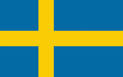
| Flag of Sweden | |
Nature in Sweden is dominated by forests and many lakes, including some of the largest in Europe. Many long rivers run from the Scandes range through the landscape, primarily emptying into the northern tributaries of the Baltic Sea. It has an extensive coastline and most of the population lives near a major body of water. With the country ranging from 55°N to 69°N, the climate of Sweden is diverse due to the length of the country. The usual conditions are mild for the latitudes with a maritime south, continental centre and subarctic north. Snow cover is infrequent in the densely populated south, but reliable in higher latitudes. Furthermore, the rain shadow of the Scandes results in quite dry winters and sunny summers in much of the country.
Currency / Language
| ISO | Currency | Symbol | Significant figures |
|---|---|---|---|
| SEK | Swedish krona | kr | 2 |
| ISO | Language |
|---|---|
| FI | Finnish language |
| SE | Northern Sami |
| SV | Swedish language |


