Nišava District (Nišava)
The district is divided into 6 municipalities and the city of Niš, which is divided into 5 municipalities.
The municipalities of the district are:
* Aleksinac
* Svrljig
* Merošina
* Ražanj
* Doljevac
* Gadžin Han
City of Niš is divided into municipalities of:
Map - Nišava District (Nišava)
Map


Country - Serbia
 |
 |
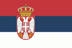
| Flag of Serbia | |
Continuously inhabited since the Paleolithic Age, the territory of modern-day Serbia faced Slavic migrations in the 6th century, establishing several regional states in the early Middle Ages at times recognised as tributaries to the Byzantine, Frankish and Hungarian kingdoms. The Serbian Kingdom obtained recognition by the Holy See and Constantinople in 1217, reaching its territorial apex in 1346 as the Serbian Empire. By the mid-16th century, the Ottomans annexed the entirety of modern-day Serbia; their rule was at times interrupted by the Habsburg Empire, which began expanding towards Central Serbia from the end of the 17th century while maintaining a foothold in Vojvodina. In the early 19th century, the Serbian Revolution established the nation-state as the region's first constitutional monarchy, which subsequently expanded its territory. Following casualties in World War I, and the subsequent unification of the former Habsburg crownland of Vojvodina with Serbia, the country co-founded Yugoslavia with other South Slavic nations, which would exist in various political formations until the Yugoslav Wars of the 1990s. During the breakup of Yugoslavia, Serbia formed a union with Montenegro, which was peacefully dissolved in 2006, restoring Serbia's independence as a sovereign state for the first time since 1918. In 2008, representatives of the Assembly of Kosovo unilaterally declared independence, with mixed responses from the international community while Serbia continues to claim it as part of its own sovereign territory.
Currency / Language
| ISO | Currency | Symbol | Significant figures |
|---|---|---|---|
| RSD | Serbian dinar | дин or din. | 2 |
| ISO | Language |
|---|---|
| BS | Bosnian language |
| HU | Hungarian language |
| SR | Serbian language |


