N'guigmi (Nguigmi)
N'guigmi is a city and Commune of fifteen thousand in the easternmost part of Niger, very near to Lake Chad – lying on its shore until the lake retreated. It is a crossroads for the traditional camel caravans of the Toureg and for traders plying North and South across the Sahara.
N'guigmi is a military centre for the region, a centre for the salt trade from Kaourar and is the last stop on the road to Chad. It is "the end of the road" and marks the end of the paved section of the Nigerien Route Nationale 1, although the sections past Diffa are notorious for their poor condition. Two unpaved highways or caravan routes connect to N'guigmi from the north, providing the main road route between Chad and Niger, and one of two land routes to the Kaourar Oasis town of Bilma.
The town lies at the mouth of the Dilia Bosso, an ancient river valley and seasonal wash that runs from the Termit Massif over 200 km to the northwest to what was the shore of Lake Chad as recently as the mid 20th century. The town was then a centre of Kanuri fishing communities. By the 2000s, even during the rainy season, the nearest access to water was at the village of Doro (a Beri-beri name for "Fishing port") 45 km southwest of N'guigmi. During the Sahel drought of the mid-1970s the shore was 85 km away from N'guigmi in Chad.
The town is the seat of the Department of N'guigmi, one of three in Diffa Region, which includes the entire north of the Region. N'guigmi is home to a large settlement of Kanuri people, as well as settled members of the traditionally pastoral Wodaabe-Fulani and Daza/Toubou ethnic groups.
Map - N'guigmi (Nguigmi)
Map
Country - Niger
 |
 |
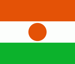
| Flag of Niger | |
It is one of the least developed countries and is also one of the poorest countries in the world by GDP per capita. Some non-desert portions of the country underwent periodic drought and desertification. The economy is concentrated around subsistence agriculture, with some export agriculture in the less arid south, and export of raw materials, including uranium ore. It faces challenges to development due to its landlocked position, desert terrain, low literacy rate, jihadist insurgencies and the world's highest fertility rates due to birth control not being used and the resulting rapid population growth.
Currency / Language
| ISO | Currency | Symbol | Significant figures |
|---|---|---|---|
| XOF | West African CFA franc | Fr | 0 |
| ISO | Language |
|---|---|
| FR | French language |
| HA | Hausa language |
| KR | Kanuri language |


