Muzaffarabad District (Muzaffarābād District)
The total population of the district according to the 2017 census is 650,370.
The main language of the district, spoken by about half of its inhabitants, is generally considered to be a variety of Pahari. Though occasionally referred to in the literature as Chibhali or Poonchi, it is locally known as Hindko. Its speakers tend to identify more with the Hindko spoken to the west, even though perceiving their speech to be only slightly different from the Pahari varieties spoken in the Bagh District and further south in Murree. The local dialect has a higher percentage of shared basic vocabulary with the central group of Pahari dialects (83–88%) than with the Hindko of the nearby Mansehra and Abbottabad districts (73–79%).
Another language spoken in the district is Gujari, native to around a third of its population. The local dialect is closely related to the Gujari varieties spoken in Hazara (83–88% similarity in basic vocabulary) and the rest of Azad Kashmir (79–86%). Kashmiri is spoken in the city of Muzaffarabad. It is distinct from, although still intelligible with, the Kashmiri of the Neelam Valley to the north. Other languages spoken include Urdu, Shina and Balti.
Map - Muzaffarabad District (Muzaffarābād District)
Map
Country - Pakistan
 |
 |
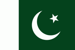
| Flag of Pakistan | |
Pakistan is the site of several ancient cultures, including the 8,500-year-old Neolithic site of Mehrgarh in Balochistan, the Indus Valley civilisation of the Bronze Age, the most extensive of the civilisations of the Afro-Eurasia, and the ancient Gandhara civilization. The region that comprises the modern state of Pakistan was the realm of multiple empires and dynasties, including the Achaemenid; briefly that of Alexander the Great; the Seleucid, the Maurya, the Kushan, the Gupta; the Umayyad Caliphate in its southern regions, the Hindu Shahis, the Ghaznavids, the Delhi Sultanate, the Mughals, the Durranis, the Omani Empire, the Sikh Empire, British East India Company rule, and most recently, the British Indian Empire from 1858 to 1947.
Currency / Language
| ISO | Currency | Symbol | Significant figures |
|---|---|---|---|
| PKR | Pakistani rupee | ₨ | 2 |
| ISO | Language |
|---|---|
| EN | English language |
| PA | Panjabi language |
| PS | Pashto language |
| SD | Sindhi language |
| UR | Urdu |


