Map - Miquelon-Langlade

Miquelon-Langlade
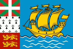
Miquelon-Langlade is the larger but less populated of the two communes (municipalities) making up the French overseas collectivity of Saint Pierre and Miquelon, located to the south of Newfoundland in the Gulf of St. Lawrence. It consists of three geological islands: Miquelon, Langlade and Le Cap, connected with tombolos. The communal seat is the settlement of Miquelon, on the northern tip, where the entire island's permanent population of 580 (as of 2019) is located. Miquelon Airport provides flights to Montreal and to nearby Saint-Pierre.

Located in the Gulf of St. Lawrence, west of Newfoundland's Burin Peninsula, Miquelon-Langlade covers a total land area of 205 km2. It comprises three islands connected by tombolos: Le Cap in the north, Miquelon (Grand Miquelon) in the center, and Langlade (Petite Miquelon) in the south.

On the south of the Miquelon Island is a large lagoon known as the Grand Barachois which is host to a large population of seals and other wildlife. Miquelon is also a well known destination for bird watching.

An 8 mi long tombolo sandspit called La Dune connects Miquelon and Langlade. In the eighteenth century it was still possible to sail a boat between Miquelon and Langlade, but by the end of that century La Dune had closed in to form an isthmus between the islands.

Located at 3 mi west of Saint Pierre Island, Langlade is an ancient peneplain drained by numerous short rivers, including the Belle, the largest, which flows to the northwest. The coast of Langlade is lined with steep cliffs, except to the northwest.

 
Map - Miquelon-Langlade
Map
Openstreetmap - Map - Miquelon-Langlade
Openstreetmap
Map - Miquelon-Langlade - Esri.WorldImagery
Esri.WorldImagery
Map - Miquelon-Langlade - Esri.WorldStreetMap
Esri.WorldStreetMap
Map - Miquelon-Langlade - OpenStreetMap.Mapnik
OpenStreetMap.Mapnik
Map - Miquelon-Langlade - OpenStreetMap.HOT
OpenStreetMap.HOT
Map - Miquelon-Langlade - CartoDB.Positron
CartoDB.Positron
Map - Miquelon-Langlade - CartoDB.Voyager
CartoDB.Voyager
Map - Miquelon-Langlade - OpenMapSurfer.Roads
OpenMapSurfer.Roads
Map - Miquelon-Langlade - Esri.WorldTopoMap
Esri.WorldTopoMap
Map - Miquelon-Langlade - Stamen.TonerLite
Stamen.TonerLite
Country - Saint_Pierre_and_Miquelon
Saint Pierre and Miquelon, officially the Territorial Collectivity of Saint-Pierre and Miquelon (Collectivité territoriale de Saint-Pierre et Miquelon ), is a self-governing territorial overseas collectivity of France in the northwestern Atlantic Ocean near the Canadian province of Newfoundland and Labrador. An archipelago of eight islands, Saint Pierre and Miquelon is a remaining vestige of the once-vast territory of New France. Its residents are French citizens; the collectivity elects its own deputy to the National Assembly and participates in senatorial and presidential elections. It covers 242 km2 of land and had a population of 6,008.

The islands are in the Gulf of St. Lawrence near the entrance of Fortune Bay, which extends into the southwestern coast of Newfoundland, near the Grand Banks of Newfoundland. St. Pierre is 19 km from Point May on the Burin Peninsula of Newfoundland and 3819 km from Brest, the nearest city in Metropolitan France. The tiny Canadian Green Island lies 10 km east of St. Pierre, roughly halfway to Point May.
Currency / Language  
ISO Currency Symbol Significant figures
EUR Euro € 2
ISO Language
FR French language
Neighbourhood - Country  
Administrative Subdivision
City, Village,...