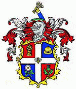
Luton
 |
The town is situated on the River Lea, about 30 mi north-north-west of London. It is 18 mi from Hertford, 20 mi from Bedford and 22.5 mi from Milton Keynes. The town's foundation dates to the sixth century as a Saxon settlement on the river, from which Luton derives its name. Luton is recorded in the Domesday Book as Loitone and Lintone and one of the largest churches in Bedfordshire, St Mary's Church, was built in the 12th century. There are local museums which explore Luton's history in Wardown Park and Stockwood Park.
Luton was, for many years, widely known for hatmaking and also had a large Vauxhall Motors factory. Car production at the plant began in 1905 and continued until the plant's closure in 2002. Production of commercial vehicles continues and the head office of Vauxhall Motors was in the town for many years, but relocated in 2019 to the village of Chalton, Bedfordshire on the northern border of the Borough of Luton. Transport is provided by London Luton Airport, which opened in 1938 and is now one of Britain's major airports, with three railway stations also in the town. The University of Bedfordshire was created from a merger with the University of Luton; two of its campuses are in Luton.
Luton Town Football Club, nicknamed the Hatters, due to the town's connection to hatmaking, has had several spells in the top flight of the English league as well as a Football League Cup triumph in 1988. They play at Kenilworth Road, their home since 1905; planning permission for a new larger stadium was approved in 2019. Luton International Carnival, the largest one-day carnival in Europe, is held on the day before the last Monday in May; the Saint Patrick's festival is held on the weekend nearest to Saint Patrick's Day as there is a large Irish community in Luton. The town also has a large Pakistani community which, along with the Irish, were attracted to employment at the Vauxhall car plant. Luton Hoo is an English country house, estate and Grade I listed building originally designed by Scottish architect Robert Adam but later transformed to the designs of Robert Smirke.
Luton's earliest recorded name is Lygea-Byrig, where Lygea means 'a river in an open field' and Byrig means 'a town'. The name shown as gradually converting to Luton over the centuries with Lvton being the used in the charter of Charles I.
Map - Luton
Map
Country - United_Kingdom
 |
 |
| Flag of the United Kingdom | |
The United Kingdom has evolved from a series of annexations, unions and separations of constituent countries over several hundred years. The Treaty of Union between the Kingdom of England (which included Wales, annexed in 1542) and the Kingdom of Scotland in 1707 formed the Kingdom of Great Britain. Its union in 1801 with the Kingdom of Ireland created the United Kingdom of Great Britain and Ireland. Most of Ireland seceded from the UK in 1922, leaving the present United Kingdom of Great Britain and Northern Ireland, which formally adopted that name in 1927. The nearby Isle of Man, Guernsey and Jersey are not part of the UK, being Crown Dependencies with the British Government responsible for defence and international representation. There are also 14 British Overseas Territories, the last remnants of the British Empire which, at its height in the 1920s, encompassed almost a quarter of the world's landmass and a third of the world's population, and was the largest empire in history. British influence can be observed in the language, culture and the legal and political systems of many of its former colonies.
Currency / Language
| ISO | Currency | Symbol | Significant figures |
|---|---|---|---|
| GBP | Pound sterling | £ | 2 |
| ISO | Language |
|---|---|
| EN | English language |
| GD | Gaelic language |
| CY | Welsh language |


