Los Santos Province (Provincia de Los Santos)
In this region are the oldest human settlements in the Isthmus of Panama. It was part of the cultural region of Gran Cocle where one of the first ceramic styles of the Americas developed. The first Europeans to explore Los Santos were the Spanish in 1515 under the command of Gonzalo de Badajoz. Upon the arrival of Europeans the area was ruled by the cacique Antataura or Cutara, and was known as the Land of Mr. Paris or Parita from Ngäbere Bari-ta meaning Confederation of Peoples, having under his control six other Indigenous chiefdoms: Guararí, Quemá, Chiracoitia, Huere, Guanata and Usagaña. The only province that was not under his dominion was Escoria. Gaspar de Espinosa succeeded in conquering and annexing Pariba to the Spanish Empire in 1516, decimating nearly all of the native population.
Geographically, Los Santos is located in the 'Arco Seco', name given to the strip of land between the Gulf of Panama and the Central Mountain range which includes areas of the provinces of Coclé, Herrera and Veraguas in the south of the Isthmus of Panama. Its climate is mainly a tropical savanna climate with moderate temperatures, strongly influenced by the winds of the Pacific Ocean crashing against the mountains, and the Humboldt Current. The average annual rainfall is 1,200 mm, allowing the growth of either dry or humid rainforest. Its highest point is located at the peak of Cerro Hoya with 1559 metres. Other major peaks are Cambutal hill (1400 metres) and Mount The Ñopos (1068 metres).
The modern province of Los Santos, was created in January 1945 replacing the defunct province of Azuero according to Cabinet Decree No. 13, leaving its territorial regime regulated by the second chapter of the Law 58 of July 29, 1998, losing the Territory of Quebro in this process.
Although Los Santos closely shares its political and social history with the rest of Panama, and the vast majority of the population speaks Spanish, the province has retained a distinct cultural identity. Los Santos' culture is the result of the passage of different peoples and civilizations that, over time, have shaped a particular cultural identity. These people, some very different from each other, have been slowly leaving an imprint seated among the inhabitants. It is one of the last regions in Panama where Spanish voseo is the standard form for use.
As is common in most of Panama, the province took its name from its ancient capital, La Villa de Los Santos. Founded on November 1569, All Saints' Day, takes its name from this Catholic celebration. The Day of All Saints is a Christian tradition instituted in honor of All Saints, known and unknown, as Pope Urban IV, to compensate for any lack of the feasts of the saints during the year by the faithful. It has roots in the Celtic festival of Samhain or Samain. The Saints (
Map - Los Santos Province (Provincia de Los Santos)
Map
Country - Panama
 |
 |
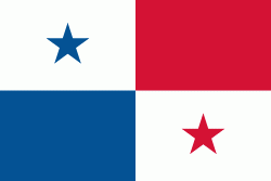
| Flag of Panama | |
Panama was inhabited by indigenous tribes before Spanish colonists arrived in the 16th century. It broke away from Spain in 1821 and joined the Republic of Gran Colombia, a union of Nueva Granada, Ecuador, and Venezuela. After Gran Colombia dissolved in 1831, Panama and Nueva Granada eventually became the Republic of Colombia. With the backing of the United States, Panama seceded from Colombia in 1903, allowing the construction of the Panama Canal to be completed by the United States Army Corps of Engineers between 1904 and 1914. The 1977 Torrijos–Carter Treaties agreed to transfer the canal from the United States to Panama on December 31, 1999. The surrounding territory was first returned in 1979.
Currency / Language
| ISO | Currency | Symbol | Significant figures |
|---|---|---|---|
| PAB | Panamanian balboa | B/ | 2 |
| USD | United States dollar | $ | 2 |
| ISO | Language |
|---|---|
| EN | English language |
| ES | Spanish language |


