Lobamba
Lobamba is a city in Eswatini, and is one of the two capitals (along with Mbabane), serving as the legislative, traditional, spiritual, seat of government of the Parliament of Eswatini, and Ludzidzini Royal Village, the residence of Queen Ntfombi, the Queen Mother.
Mswati III lives about 10 km away at the Lozitha Palace. The King and Queen Mother participate in annual December and January Incwala ceremonies and August and September Reed Dancees at Ludzidzini Royal Village, also known as the Royal Kraal.
Key attractions are the Parliament, National Museum of Eswatini, Mlilwane Wildlife Sanctuary, and the King Sobhuza II Memorial Park. The Embo State Palace, not open to visitors, was built by the British government for the polygamous King Sobhuza II, whose family included 600 children. He led the movement for Eswatini's independence from the United Kingdom and was its first prime minister.
It is located in the western part of the country in the woodland "Valley of Heaven", or Ezulwini Valley. It is 16 km from Mbabane, in the district of Hhohho and has a subtropical climate with wet summers and dry winters. In 1997 its population was 3,625. Its population in 2006 was 11,000. Across the country, 84.3% of its people are Swazi and 9.9% are Zulu. The remainder are Tsonga (2.5%), Indian (1.6%) and others (1.7%). Its official languages are Swazi and English.
Map - Lobamba
Map


Country - Swaziland
 |
 |
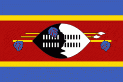
| Flag of Eswatini | |
The population is composed primarily of ethnic Swazis. The prevalent language is Swazi (siSwati in native form). The Swazis established their kingdom in the mid-18th century under the leadership of Ngwane III. The country and the Swazi take their names from Mswati II, the 19th-century king under whose rule the country was expanded and unified; its boundaries were drawn up in 1881 in the midst of the Scramble for Africa. After the Second Boer War, the kingdom, under the name of Swaziland, was a British high commission territory from 1903 until it regained its full independence on 6 September 1968. In April 2018, the official name was changed from Kingdom of Swaziland to Kingdom of Eswatini, mirroring the name commonly used in Swazi.
Currency / Language
| ISO | Currency | Symbol | Significant figures |
|---|---|---|---|
| SZL | Swazi lilangeni | L | 2 |
| ISO | Language |
|---|---|
| EN | English language |
| SS | Swati language |