Lilongwe District (Lilongwe District)
Lilongwe is a district in the Central Region of Malawi. The capital is Lilongwe.
The district covers an area of 6,159 km2 and has a population of 1,346,360. Lilongwe was officially declared a township in 1947. Life President Ngwazi Hastings Kamuzu Banda declared Lilongwe the capital city of Malawi on January 1, 1975 after a ten-year building period during which many people were forcibly displaced to make way for the new government buildings. Prior to 1975, the capital was the much smaller southern city of Zomba. Lilongwe is located 1050 m above sea level and has a temperature range between 65 - 75 F.
The airport is very small but quite adequate. It is served by Kenya Airways out of Nairobi, South African Airways, proflight, Fastjet and Ethiopian Airways. In 2014 the government of Malawi relaunched its national airline and flies regionally to destinations like Dar es Salaam and Lusaka
At the time of the 2018 Census of Malawi, the distribution of the population of Lilongwe District by ethnic group was as follows:
* 94.5% Chewa
* 2.1% Ngoni
* 1.5% Yao
* 1.0% Lomwe
* 0.4% Tumbuka
* 0.1% Sena
Map - Lilongwe District (Lilongwe District)
Map


Country - Malawi
 |
 |
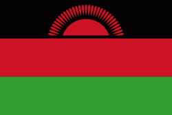
| Flag of Malawi | |
In 1891, the area was colonised by the British and became a protectorate of the United Kingdom known as Nyasaland. In 1953, it became a protectorate within the semi-independent Federation of Rhodesia and Nyasaland. The Federation was dissolved in 1963. In 1964, the protectorate was ended: Nyasaland became an independent country under Queen Elizabeth II, and was renamed Malawi. Two years later it became a republic. It gained full independence from the United Kingdom, and by 1970 had become a totalitarian one-party state under the presidency of Hastings Banda, who remained in this role until 1994. Malawi has a democratic, multi-party republic headed by an elected president. Lazarus Chakwera of the Malawi Congress Party led the Tonse Alliance grouping of nine political parties and won the court-mandated Presidential Election rerun held on 23 June 2020 after the May 2019 Presidential Election was annulled due to electoral irregularities. The country's military, the Malawian Defence Force, includes an army, a navy, and an air wing. Malawi's foreign policy is pro-Western. It maintains positive diplomatic relations with most countries, and participates in several international organisations, including the United Nations, the Commonwealth of Nations, the Southern African Development Community (SADC), the Common Market for Eastern and Southern Africa (COMESA), and the African Union (AU).
Currency / Language
| ISO | Currency | Symbol | Significant figures |
|---|---|---|---|
| MWK | Malawian kwacha | MK | 2 |
| ISO | Language |
|---|---|
| NY | Chichewa language |