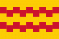
Leerdam
 |
 |
The south border of the town is formed by the river Linge. The name originates from a dam in the river Lede which was a branch from the river Linge towards Meerkerk. Leerdam is situated almost exactly in the middle of the three highways A2, A15 and A27.
Leerdam received city rights in 1407. The small river Linge, bordered by beautiful water meadows, defines the atmosphere and tone of the landscape. Several centuries ago Leerdam formed a part of the Vijfheerenlanden domain, before it was raised to the level of County in 1498.
In 1551, Leerdam, together with Acquoy, became property of the House of Orange and part of the County of Holland.
The rich history of Leerdam can be found in well-kept historic buildings such as the Grote Kerk (Great Church), the Hofje van Mevrouw van Aerden (Mrs. Aerden Almshouses, now a museum), the remaining and restored city walls on the Zuidwal and the Oude Raadhuis (Old City Hall).
In South Africa a fort was built by the Dutch East India Company between 1666 and 1679 in the coastal city Cape Town. It is called Castle of Good Hope. The corners of this fort received names in honour of William of Orange-Nassau and because Leerdam was part of the House of Orange-Nassau one of those corners were named Leerdam.
Map - Leerdam
Map
Country - Netherlands
 |
 |
The four largest cities in the Netherlands are Amsterdam, Rotterdam, The Hague and Utrecht. Amsterdam is the country's most populous city and the nominal capital. The Hague holds the seat of the States General, Cabinet and Supreme Court. The Port of Rotterdam is the busiest seaport in Europe. Schiphol is the busiest airport in the Netherlands, and the third busiest in Europe. The Netherlands is a founding member of the European Union, Eurozone, G10, NATO, OECD, and WTO, as well as a part of the Schengen Area and the trilateral Benelux Union. It hosts several intergovernmental organisations and international courts, many of which are centred in The Hague.
Currency / Language
| ISO | Currency | Symbol | Significant figures |
|---|---|---|---|
| EUR | Euro | € | 2 |
| ISO | Language |
|---|---|
| NL | Dutch language |
| FY | West Frisian language |


