Kokshetau
 |
It has 150,649 inhabitants (2022 est.), up from 123,389 (1999 census), while Akmola Region had a total population of 738,587 (2019 est.), down from 1,061,820 (1989 census), making it the tenth most populous region in Kazakhstan. The city's history has been influenced by people of many nations and religions. Kokshetau retains multiethnic population, with 59% ethnic Kazakhs (up from 36%), the rest being mostly 28% ethnic Russians (down from 42%) and other ethnic groups such as Ukrainians, Tatars and Germans. Kokshetau City Administration (area of 425 km2), with a population of roughly 165,153 residents, includes one settlement administration (which consists of the work settlement of Stantsyonny) and the Krasnoyarsk rural district, which includes two rural settlements (the villages of Krasny Yar and Kyzyl Zhuldyz).
The city is considered to have been founded in 1824 as a military fortress, while it was granted city status in 1895. It was the centre of Kokshetau Region, which was abolished in 1997. It is well known for its nature and tourist sites, such as Burabay and Zerendi, among others. The city's main football team is FC Okzhetpes. Kokshetau is about 185 km from Petropavl, 300 km northwest of the national capital Astana along the A1, 318 km from Omsk along the A13, and 384 km from Kostanay. The city is served by Kokshetau Airport (KOV).
Kokshetau is an important economic, educational, and cultural centre of the Akmola Region. Attractions in and around Kokshetau include Akmola Regional Museum of History and Local Lore, Bukpa Hill, Kokshetau City Park, Kokshetau City History Museum, Museum of Literature and Art. The northwest entrance to Burabay National Park (Burabai memlekettık ūlttyq tabiği parkı) and Burabay spa town is a little over 43 miles (70 km) from Kokshetau. Kokshetau was awarded the title Kazakhstan City of Culture for the year 2021.
The name Kokshetau (Kökşetau; ) is of Kazakh origin literally meaning a, kokshe / "", meaning and tau / "", meaning — the name of always turning blue, as if in a deep haze of mountains, thus "Blueish Mountain/Smoky-Blue Mountain" in English. That is how from ancient times Kazakhs were calling the highest mountain in Akmola Region "Mount Kokshe" (947 m), located 60 miles away from the city. Following the collapse of the Soviet Union, Kazakhstan declared its independence on 16 December 1991 (Kazakhstan Independence Day), and on 7 October 1993, by the Resolution of the Presidium of the Supreme Council of the Republic of Kazakhstan, the city of Kokchetav (Кокчета́в) was renamed to the more Kazakh sounding Kokshetau as part of the government's campaign to apply Kazakh names to cities, but the city's airport still retains KOV as its IATA code. In Russian it became known as Kokshetau.
Map - Kokshetau
Map
Country - Kazakhstan
 |
 |
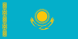
| Flag of Kazakhstan | |
The country dominates Central Asia economically and politically, generating 60 percent of the region's GDP, primarily through its oil and gas industry; it also has vast mineral resources. Officially, it is a democratic, secular, unitary, constitutional republic with a diverse cultural heritage, and has the highest Human Development Index ranking in the region. Kazakhstan is a member state of the United Nations, World Trade Organization, Commonwealth of Independent States, Shanghai Cooperation Organisation, Eurasian Economic Union, Collective Security Treaty Organization, Organization for Security and Cooperation in Europe, Organization of Islamic Cooperation, Organization of Turkic States, and International Organization of Turkic Culture.
Currency / Language
| ISO | Currency | Symbol | Significant figures |
|---|---|---|---|
| KZT | Kazakhstani tenge | ₸ | 2 |
| ISO | Language |
|---|---|
| KK | Kazakh language |
| RU | Russian language |


