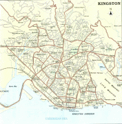
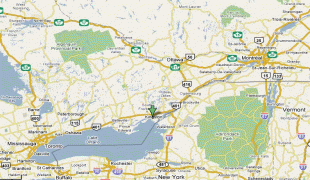
Kingston (Kingston)
Kingston (Norf'k: Daun a'Taun ) is the administrative centre of the Australian external territory of Norfolk Island. The Norfolk Island Regional Council is based in Kingston. The settlement is the second-oldest in Australia, founded a little over a month after Sydney. It is part of the Kingston and Arthur's Vale Historic Area World Heritage site.
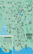
Kingston is located on the east–west aligned Kingston Plain which rises from the coast to about 20 m above sea level in the foothills of the Kingston escarpment. The plain is 1.5 km long by about 500 m wide, with calcareous lime sands to the south along the coast and basaltic clays to the north along the foothills. The western end of the plain is marked by the 60 m high Flagstaff Hill. Watermill Creek traverses the plain after leaving Arthur's Vale to the north-west, and is joined by Town Creek and several minor tributaries to form the Kingston swamps before draining into Emily Bay. Most of the accessible beaches on the island are located along the Kingston foreshores. Southwards, Emily Bay and Slaughter Bay open into the Kingston lagoon and reefs and the broad expanse of Sydney Bay. Eastwards, Cemetery Bay opens directly into the South Pacific Ocean.
Kingston is located on the east–west aligned Kingston Plain which rises from the coast to about 20 m above sea level in the foothills of the Kingston escarpment. The plain is 1.5 km long by about 500 m wide, with calcareous lime sands to the south along the coast and basaltic clays to the north along the foothills. The western end of the plain is marked by the 60 m high Flagstaff Hill. Watermill Creek traverses the plain after leaving Arthur's Vale to the north-west, and is joined by Town Creek and several minor tributaries to form the Kingston swamps before draining into Emily Bay. Most of the accessible beaches on the island are located along the Kingston foreshores. Southwards, Emily Bay and Slaughter Bay open into the Kingston lagoon and reefs and the broad expanse of Sydney Bay. Eastwards, Cemetery Bay opens directly into the South Pacific Ocean.
Map - Kingston (Kingston)
Map


Country - Norfolk_Island
 |
 |
The first known settlers in Norfolk Island were East Polynesians but they had already departed when Great Britain settled it as part of its 1788 settlement of Australia. The island served as a convict penal settlement from 6 March 1788 until 5 May 1855, except for an 11-year hiatus between 15 February 1814 and 6 June 1825, when it lay abandoned. On 8 June 1856, permanent civilian residence on the island began when descendants of the Bounty mutineers were relocated from Pitcairn Island. In 1914, the UK handed Norfolk Island over to Australia to administer as an external territory.
Currency / Language
| ISO | Currency | Symbol | Significant figures |
|---|---|---|---|
| AUD | Australian dollar | $ | 2 |
| ISO | Language |
|---|---|
| EN | English language |