Map - Kampong Speu Province (Kampong Speu)

Kampong Speu Province (Kampong Speu)
Kampong Speu (កំពង់ស្ពឺ, Kâmpóng Spœ ; ) is a province of Cambodia. It borders the provinces of Pursat and Kampong Chhnang to the north, Kandal to the east, Takéo to the southeast, Kampot to the south and Koh Kong to the west. Its capital is the town of Chbar Mon.

Kampong Speu in Khmer means "starfruit port" or "starfruit harbor". In Khmer, kampong is a place-name element, meaning "port" or "harbor". It derives from the Austronesian language, Malay, in which it means "village". Speu in the Khmer language means "starfruit".

 
Map - Kampong Speu Province (Kampong Speu)
Country - Khmer_Republic
Flag of Cambodia
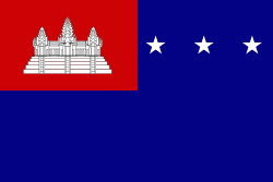
The Khmer Republic (សាធារណរដ្ឋខ្មែរ, ; République khmère) was a Cambodian state under the United States-backed military dictatorship of Marshal Lon Nol from 1970 to 1975. Its establishment was formally declared on 9 October 1970, following the 18 March 1970 coup d'état which saw the overthrow of Norodom Sihanouk's government and the abolishment of the Cambodian monarchy.

The main cause of the coup was Norodom Sihanouk's tolerance of North Vietnamese military activity within Cambodia's borders; Vietnamese communist forces had gained de facto control over vast areas of eastern Cambodia as a result. Another important factor was the dire state of the Cambodian economy, an indirect result of Sihanouk's policies of pursuing neutrality.
Currency / Language  
ISO Currency Symbol Significant figures
KHR Cambodian riel ៛ 2
Neighbourhood - Country  
  •  Laos 
  •  Thailand 
  •  Vietnam 
Administrative Subdivision
Country, State, Region,...
City, Village,...