Juraynah
Juraynah جرينة is a town in the Madaba Governorate of north-western Jordan.
It is located to the north of Madaba, about five kilometers from the governorate center, and about twenty-six kilometers south of Amman. Administratively, it is affiliated to the Greater Madaba municipality, and to the Juraynah district of the Madaba governorate. Juraynah is the northern gateway to Madaba Governorate from Amman.
The name of the town has not changed over the years, and this name is taken from the word "juran" "جرن", which is the rocky expanse of water in the rocks, as if the village, in its low location between the neighboring villages, was shaped like a water jar, and the name was reduced to green, and then it was feminized with time, perhaps to endearment in the place, so it became The name "Jurayn" "جرين", and it became known to this village to distinguish it from villages similar to it, because its name became associated with the clan (Shawabkeh) that inhabited the village here in the eighteenth century, and then its name was known as Jurenet Alshawabkeh "جرينة الشوابكة", and after an actual and tangible move took place in it. The framework of the agricultural sector in it, and this was observed in the agricultural activity, and reflected greenery, fruits, and farmers throughout the area of the place, the people of the village began to call them among themselves the name of Junaynah which mean garden instead of Juraynah.
With this simplicity, the elders of the village talk about Junaynah, the interpretation of the meaning of the name, the simplification of its connotations related to the interpretation of an incubator of water, and a comfortable connotation of the place between the surrounding heights, and therefore we did not go into much detail in the semantics of the interpretation and were satisfied with what we extracted from the words of the people of the village.
Map - Juraynah
Map
Country - Jordan
 |
 |
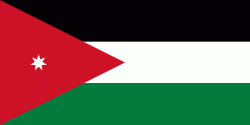
| Flag of Jordan | |
Modern-day Jordan has been inhabited by humans since the Paleolithic period. Three stable kingdoms emerged there at the end of the Bronze Age: Ammon, Moab and Edom. In the third century BC, the Arab Nabataeans established their Kingdom with Petra as the capital. Later rulers of the Transjordan region include the Assyrian, Babylonian, Roman, Byzantine, Rashidun, Umayyad, Abbasid, and the Ottoman empires. After the Great Arab Revolt against the Ottomans in 1916 during World War I, the Greater Syria region was partitioned by Britain and France. The Emirate of Transjordan was established in 1921 by the Hashemite, then Emir, Abdullah I, and the emirate became a British protectorate. In 1946, Jordan gained independence and became officially known in Arabic as the Hashemite Kingdom of Jordan. The country captured the West Bank during the 1948 Arab–Israeli War and annexed it until it was lost to Israel in 1967. Jordan renounced its claim to the territory in 1988, and became the second Arab state to sign a peace treaty with Israel in 1994.
Currency / Language
| ISO | Currency | Symbol | Significant figures |
|---|---|---|---|
| JOD | Jordanian dinar | دا | 3 |
| ISO | Language |
|---|---|
| AR | Arabic language |
| EN | English language |


