Isabel Province (Isabel Province)
 |
The province has an economy dominated by subsistence agriculture with occasional plantations for cash crops such as copra, and by logging activities. The province is seldom visited by tourists due to poor infrastructure, lack of roads, hotels, modern medical care, and endemic malaria. Most areas have a "Rest House", a house where guests can seek accommodation for the night or two, but many residents are willing to take in visitors for the night.
Santa Isabel is the longest Island in the Solomon Islands. The first European contact to the Solomon Islands was made by Spanish navigator Álvaro de Mendaña de Neira in 1568, who gave them their name. The highest point is Mount Kubonitu, also known as Mount Sasari at 1120 m.
Isabel Province is sub-divided into the following wards:
* Isabel Province (26,158)
* Kia (1,929)
* Baolo (1,148)
* Kokota (1,177)
* Hovikoilo (1,988)
* Buala (2,813)
Map - Isabel Province (Isabel Province)
Map


Country - Solomon_Islands
 |
 |
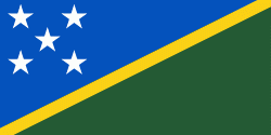
| Flag of the Solomon Islands | |
The islands have been settled since at least some time between 30,000 and 28,800 BCE, with later waves of migrants, notably the Lapita people, mixing and producing the modern indigenous Solomon Islanders population. In 1568, the Spanish navigator Álvaro de Mendaña was the first European to visit them. Though not named by Mendaña, it is believed that the islands were called "the Solomons" by those who later received word of his voyage and mapped his discovery. Mendaña returned decades later, in 1595, and another Spanish expedition, led by Portuguese navigator Pedro Fernandes de Queirós, visited the Solomons in 1606. Britain defined its area of interest in the Solomon Islands archipelago in June 1893, when Captain Gibson, R.N., of HMS Curacoa (1878), declared the southern Solomon Islands a British protectorate. During World War II, the Solomon Islands campaign (1942–1945) saw fierce fighting between the United States, British Commonwealth forces and the Empire of Japan, including the Battle of Guadalcanal.
Currency / Language
| ISO | Currency | Symbol | Significant figures |
|---|---|---|---|
| SBD | Solomon Islands dollar | $ | 2 |
| ISO | Language |
|---|---|
| EN | English language |