Iklin (L-Iklin) is a village in the Central Region of Malta, with a population of 3,247 as at 2021. Iklin was established in the mid-20th century; however some archaeological sites and a medieval chapel, named as St. Michael Chapel, are proof to earlier settlements. Until recently, the town was considered to form part of the Three villages of Malta, as part of Lija. With the separation of Iklin from Lija, Iklin is no longer part of the three villages. It is bordered by Għargħur, San Ġwann, Birkirkara, Balzan and Naxxar.
Iklin is divided in Lower Iklin siding on the Birkirkara bypass and the Upper Iklin. In Lower Iklin houses are built side by side, in general villas and maisonettes but also recently some apartments. In Upper Iklin land is on a hill close to Naxxar and land is considered more expensive; in general the land consists of villas and farmhouses. The two sides share two common facts, the neighborhoods structural design and the general silence living areas.
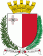
The name of Iklin is derived from the herb Rosmarinus officinalis, which is known as l-iklin in Maltese. The valley in which the herb grew has now been built up. The coat of arms depicts a shield on a blue background with Saint Michael in the centre and, the six roses of L-Iklin on the borders.