Ho Chi Minh City (Ho Chi Minh City)
Saigon was the capital of French Indochina from 1887 to 1902, and again from 1945 until its cessation in 1954. Following the partition of French Indochina, it became the capital of South Vietnam until the Fall of Saigon in 1975. The communist government renamed Saigon in honour of Hồ Chí Minh shortly after the Fall of Saigon. Beginning in the 1990s, the city underwent rapid modernisation and expansion, contributing to Vietnam's post-war economic recovery.
It is known for its well-preserved French colonial architecture and vibrant street life. Its varied cultural institutions, which include historic landmarks, walking streets, museums and galleries, attracts over 8 million international visitors each year.
Ho Chi Minh City is a major centre for finance, media, technology, education, and transportation. The city generates nearly a quarter of the country's total GDP, and is home to many multinational companies. It has a Human Development Index of 0.795 (high), ranking second among all municipalities and provinces of Vietnam. Tân Sơn Nhất International Airport, the main airport serving the city, is the busiest airport in the country by passenger traffic, accounting for nearly half of all international arrivals to Vietnam.
Originally, There was a Cham settlement had settled in the area and was called Baigaur. The Cambodians then took over the Cham village of Baigaur and renamed it Prey Nokor, a small fishing village. Over time, under the control of the Vietnamese, it was officially renamed Gia Định, a name that was retained until the time of the French conquest in the 1860s, when it adopted the name Sài Gòn, westernized as Saïgon, although the city was still indicated as 嘉定 on Vietnamese maps written in chữ Hán until at least 1891.
The current name, Ho Chi Minh City, was given after reunification in 1976 to honour Ho Chi Minh. Even today, however, the informal name of Sài Gòn remains in daily speech. However, there is a technical difference between the two terms: Sài Gòn is commonly used to refer to the city center in District 1 and the adjacent areas, while Ho Chi Minh City refers to all of its urban and rural districts.
Map - Ho Chi Minh City (Ho Chi Minh City)
Map
Country - Vietnam
 |
 |
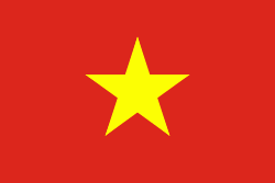
| Flag of Vietnam | |
Vietnam was inhabited by the Paleolithic age, with states established in the first millennium BC on the Red River Delta in modern-day northern Vietnam. The Han dynasty annexed Northern and Central Vietnam under Chinese rule from 111 BC, until the first dynasty emerged in 939. Successive monarchical dynasties absorbed Chinese influences through Confucianism and Buddhism, and expanded southward to the Mekong Delta, conquering Champa. The Nguyễn—the last imperial dynasty—surrendered to France in 1883. Following the August Revolution, the nationalist Viet Minh under the leadership of communist revolutionary Ho Chi Minh proclaimed independence from France in 1945.
Currency / Language
| ISO | Currency | Symbol | Significant figures |
|---|---|---|---|
| VND | Vietnamese đồng | ₫ | 0 |
| ISO | Language |
|---|---|
| KM | Central Khmer language |
| ZH | Chinese language |
| EN | English language |
| FR | French language |
| VI | Vietnamese language |


