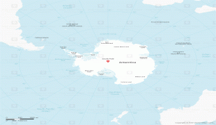
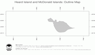
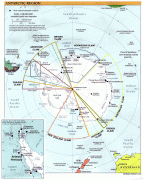
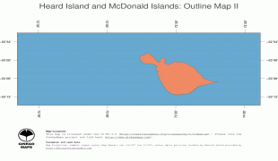
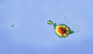
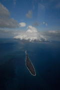
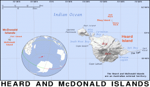
Heard Island and McDonald Islands (Territory of Heard Island and McDonald Islands)
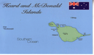
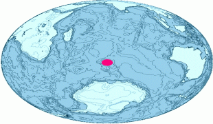
The islands are among the most remote places on Earth: They are located about 4,099 km southwest of Perth, 3,845 km southwest of Cape Leeuwin, Australia, 4,200 km southeast of South Africa, 3,830 km southeast of Madagascar, 1,630 km north of Antarctica, and 450 km southeast of the Kerguelen Islands (part of French Southern and Antarctic Lands). The islands, which are uninhabited, can only be reached by sea, which from Australia takes two weeks in the vessels normally used to access them.
Neither island cluster had recorded visitors until the mid-1850s.
An American sailor, John Heard, on the ship Oriental, sighted Heard Island on 25 November 1853, en route from Boston to Melbourne. He reported the discovery one month later and had the island named after him. His wife Fidelia Heard provided the first written description and drawings of the island. William McDonald aboard the Samarang discovered the nearby McDonald Islands six weeks later, on 4 January 1854.
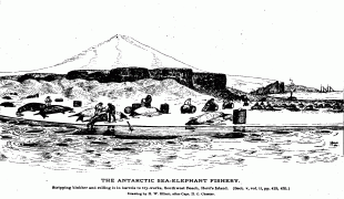
No landing took place on the islands until March 1855, when sealers from the Corinthian, led by Erasmus Darwin Rogers, went ashore at a place called Oil Barrel Point. From 1855 to 1882 a number of American sealers spent a year or more on the island, living in appalling conditions in dark smelly huts, also at Oil Barrel Point. At its peak the community consisted of 200 people. By 1880, sealers had wiped out most of the seal population and then left the island. In all, the islands furnished more than 100,000 barrels of elephant seal oil during this period.
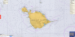
A number of wrecks have occurred in the vicinity of the islands. There is also a discarded building left from John Heard's sealing station that is situated near Atlas Cove.
The islands were formally claimed by the United Kingdom in 1910 and transferred to Australia on 26 December 1947. The receipt was confirmed in letters exchanged on 19 December 1950. The archipelago became a World Heritage Site in 1997.
The first recorded aircraft landing on McDonald Island was made by Australian scientists Grahame Budd and Hugh Thelander on 12 February 1971, using a helicopter.
There were at least five private expeditions to Heard Island between 1965 and 2000. Several amateur radio operators have visited Heard, often associated with scientific expeditions. The first activity there was in 1947 by Alan Campbell-Drury. Two amateur radio DXpeditions to the island took place in 1983 using the callsigns VK0HI (the Anaconda expedition) and VK0JS and VK0NL (the Cheynes II expedition), with a further operation in January 1997 (VK0IR). The DXpedition in March 2016 (VK0EK) was organised by Cordell Expeditions, and made over 75,000 radio contacts.
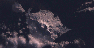
Mawson Peak, atop Big Ben, was first climbed on 25 January 1965 by five members of the Southern Indian Ocean Expedition to Heard Island (sometimes referred to as the Patanela expedition). The second ascent was made by five members of the Heard Island Expedition 1983 (sometimes referred to as the Anaconda expedition). A helicopter landing was made at the summit by an ANARE team on 21 December 1986. An Australian Army team was successful in making the third ascent in 2000.