Groot Constantia (Groot Constantia)
Groot Constantia is the oldest wine estate in South Africa and provincial heritage site in the suburb of Constantia in Cape Town, South Africa.
"Groot" in Dutch and Afrikaans translates as "great" (as in large) in English.
In 1685, during an annual visit to the Cape, Hendrik Adriaan van Rheede tot Drakenstein granted the grounds of Groot Constantia to Simon van der Stel the VOC Governor of the Cape of Good Hope.
Van der Stel built the house and used the land to produce wine as well as other fruit and vegetables, and for cattle farming. Following Van der Stel's death in 1712 the estate was broken up and sold in three parts: Groot Constantia; Klein Constantia; and Bergvliet.
In 1779 the portion of the estate including Van der Stel's Cape Dutch-style manor house was sold to the Cloete family, who planted extensive vineyards and extended and improved the mansion by commissioning the architect Louis Michel Thibault. The wine cellar was added by Cloete in 1791. The house remained in the possession of the Cloete family until 1885, during which period the estate became famous for its production of Constantia dessert wine.
In 1885 Groot Constantia was purchased by the government of the Cape of Good Hope and was used as an experimental wine and agricultural estate. Following a disastrous fire in 1925 the house was extensively restored.
In the year 1925 the manor house completely burnt down. Funds were raised to reconstruct it to its original Cape Dutch splendour.
In 1969 the manor house became part of the South African Cultural History Museum, and in 1993 the estate passed into the ownership of the Groot Constantia Trust. The exhibition in the house is managed by Iziko South African Museum, and is particularly focused on rural slavery and the life of slaves during the early Cape colonial period.
Today, other estates have joined Groot Constantia to form the scenic Constantia wine route. These estates include Klein Constantia, Buitenverwachting, Constantia Uitsig, Steenberg, Constantia Glen, Eagles Nest and High Constantia.
Map - Groot Constantia (Groot Constantia)
Map
Country - South_Africa
 |
 |
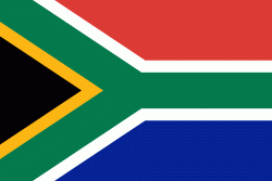
| Flag of South Africa | |
About 80% of the population are Black South Africans. The remaining population consists of Africa's largest communities of European (White South Africans), Asian (Indian South Africans and Chinese South Africans), and multiracial (Coloured South Africans) ancestry. South Africa is a multiethnic society encompassing a wide variety of cultures, languages, and religions. Its pluralistic makeup is reflected in the constitution's recognition of 11 official languages, the fourth-highest number in the world. According to the 2011 census, the two most spoken first languages are Zulu (22.7%) and Xhosa (16.0%). The two next ones are of European origin: Afrikaans (13.5%) developed from Dutch and serves as the first language of most Coloured and White South Africans; English (9.6%) reflects the legacy of British colonialism and is commonly used in public and commercial life.
Currency / Language
| ISO | Currency | Symbol | Significant figures |
|---|---|---|---|
| ZAR | South African rand | Rs | 2 |
| ISO | Language |
|---|---|
| AF | Afrikaans language |
| EN | English language |
| ST | Sotho language |
| SS | Swati language |
| TS | Tsonga language |
| TN | Tswana language |
| VE | Venda language |
| XH | Xhosa language |
| ZU | Zulu language |


