Grigiškės
 |
Mounds from the 5th to 10th centuries show that the surrounding lands have been inhabited for a long time. Kunigiškės, Kauno Vokė and Salos-Afindevičiai villages were there, with the modern Grigiškės settlement being founded only in the 20th century.
The name in 1923 was given by Grzegorz Kurec, an industrialist of Belarusian origin, who built a paper and cardboard factory and a water power plant with a unique Grigiškės water aqueduct.
In the aftermath of World War II, the factory was expanded, with many new workplaces being created. The town grew rapidly mainly due to the migration of Belarusian workers from Byelorussian Soviet Socialist Republic as well as Lithuanian deportees returning from Siberia, who were prohibited to live in Vilnius, settled here. In the Soviet era, Grigiškės factory also manufactured fiberboards.
On 15 May 1958, Grigiškės became an urban-type settlement and the first Lithuanian schools were established. In 1968, a library was built. On 10 December 1996, by the decree of the Lithuanian president, the Grigiškės coat-of-arms was finally validated. Since 19 March 2000 (official since 21 December 1999), Grigiškės has been part of the Vilnius city municipality.
Map - Grigiškės
Map
Country - Lithuanian_Soviet_Socialist_Republic_(1918–1919)
 |
 |
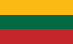
| Flag of Lithuania | |
Germany had lost World War I and signed the Compiègne Armistice on 11 November 1918. Its military forces then started retreating from the former Ober Ost territories. Two days later, the government of the Soviet Russia renounced the Treaty of Brest-Litovsk, which had assured Lithuania's independence. Soviet forces then launched a westward offensive against Estonia, Latvia, Lithuania, Poland and Ukraine in an effort to spread the global proletarian revolution and replace national independence movements with Soviet republics. Their forces followed retreating German troops and reached Lithuania by the end of December 1918.
Currency / Language
| ISO | Currency | Symbol | Significant figures |
|---|---|---|---|
| EUR | Euro | € | 2 |
| ISO | Language |
|---|---|
| LT | Lithuanian language |
| PL | Polish language |
| RU | Russian language |


