Gizo (Gizo)
Gizo is the capital of the Western Province in Solomon Islands. With a population of 7,177 (as of 2019), it is the second largest town in the country. It is situated on Ghizo Island approximately 380 km west-northwest of the capital, Honiara, and is just southwest of the larger island of Kolombangara.
Gizo has a small landing strip on the nearby island of Nusatupe to the north east of the town, making it relatively developed compared to other settlements in the general vicinity. These days Gizo is a tourism centre with diving and surfing being popular activities.
This area of Solomon Islands has had a history of headhunting. According to local stories the Gizo tribe were notorious in this activity. As a consequence the surrounding local tribes took the unusual step of joining together to obliterate the Gizo tribe. The stories further relate that the only survivors were a Gizo woman and her son.
This event led to Ghizo island being declared as a property of the state, rather than the usual customary ownership prevalent in much of the rest of the Solomons. As a secondary consequence becoming an administrative and business centre because of the relative ease with which registered land titles could be obtained.
The Methodist Mission in the Western Province was established by Rev. John Frances Goldie in 1902. He dominated the mission and gained the loyalty of Solomon Islander members of his church. The relationship with the colonial administrators of the British Solomon Island Protectorate were also fraught with difficulty, at this time due to Goldie's effective control over the Western Solomon Islands.
From 1927 to 1934 Dr Edward Sayers worked at the Methodist mission where he established a hospital at Gizo and also at Munda and Vella Lavella, and carried out fieldwork in the treatment of malaria.
St. Peter's Cathedral, also called Gizo Cathedral, is the cathedral affiliated to the Catholic Church that is located in Gizo. It was inaugurated and blessed by Bishop EJ Crawford on June 18, 1964.
Map - Gizo (Gizo)
Map


Country - Solomon_Islands
 |
 |
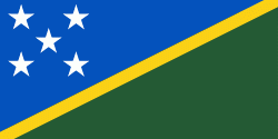
| Flag of the Solomon Islands | |
The islands have been settled since at least some time between 30,000 and 28,800 BCE, with later waves of migrants, notably the Lapita people, mixing and producing the modern indigenous Solomon Islanders population. In 1568, the Spanish navigator Álvaro de Mendaña was the first European to visit them. Though not named by Mendaña, it is believed that the islands were called "the Solomons" by those who later received word of his voyage and mapped his discovery. Mendaña returned decades later, in 1595, and another Spanish expedition, led by Portuguese navigator Pedro Fernandes de Queirós, visited the Solomons in 1606. Britain defined its area of interest in the Solomon Islands archipelago in June 1893, when Captain Gibson, R.N., of HMS Curacoa (1878), declared the southern Solomon Islands a British protectorate. During World War II, the Solomon Islands campaign (1942–1945) saw fierce fighting between the United States, British Commonwealth forces and the Empire of Japan, including the Battle of Guadalcanal.
Currency / Language
| ISO | Currency | Symbol | Significant figures |
|---|---|---|---|
| SBD | Solomon Islands dollar | $ | 2 |
| ISO | Language |
|---|---|
| EN | English language |