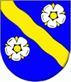
Gamprin
 |
 |
Evidence of human settlement from the Stone, Bronze and Iron Ages have been found in Gamprin. Within the territory of the parish there is the archaeological site of Lutzengüetle.
The name is derived from the Old Romansh camp Rin (field on the Rhine). It was first mentioned in about 1150 as Camporin, and in 1253 it was mentioned as Gamperin.
The church, dedicated to Mother Mary, was built in 1481, but has antecedents dating back to 1045. In 1499, the village was pillaged by the Swiss Confederates. The oldest preserved village charter from 1643 describes the rights and duties of the villagers to use pastures and forests. Lower Country men swore allegiance to the Prince in 1699 at Bendern.
In the 18th and 19th centuries, Bendern ran one of the five ferries in the Liechtenstein section of the Rhine and connected it with Haag on the opposite side of the river, now in the Swiss municipality of Sennwald. A wooden bridge was built across the river in 1867-68.
Map - Gamprin
Map
Country - Liechtenstein
 |
 |
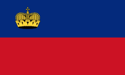
| Flag of Liechtenstein | |
Liechtenstein is bordered by Switzerland to the west and south and Austria to the east and north. It is Europe's fourth-smallest country, with an area of just over 160 km2 and a population of 38,749. Divided into 11 municipalities, its capital is Vaduz, and its largest municipality is Schaan. It is also the smallest country to border two countries. Liechtenstein is a doubly landlocked country between Switzerland and Austria.
Currency / Language
| ISO | Currency | Symbol | Significant figures |
|---|---|---|---|
| CHF | Swiss franc | Fr | 2 |
| ISO | Language |
|---|---|
| DE | German language |


