Map - Constanţa County (Constanța)

Constanţa County (Constanța)
Constanța is a county (județ) of Romania on the border with Bulgaria, in the Dobruja region. Its capital city is also named Constanța.

In 2011, it had a population of 684,082 and the population density was 96/km2. The degree of urbanization is much higher (about 75%) than the Romanian average. In recent years the population trend is:

The majority of the population are Romanians. There are important communities of Turks and Tatars, remnants of the time of Ottoman rule. Currently the region is the centre of the Muslim minority in Romania. A great number of Aromanians have migrated to Dobruja in the last century, and they consider themselves a cultural minority rather than an ethnic minority. There are also Romani.

 
Map - Constanţa County (Constanța)
Map
Country - Romania
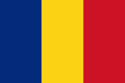
Flag of Romania
Romania (România ) is a country located at the crossroads of Central, Eastern, and Southeastern Europe. It borders Bulgaria to the south, Ukraine to the north, Hungary to the west, Serbia to the southwest, Moldova to the east, and the Black Sea to the southeast. It has a predominantly temperate-continental climate, and an area of 238397 km2, with a population of around 19 million. Romania is the twelfth-largest country in Europe and the sixth-most populous member state of the European Union. Its capital and largest city is Bucharest, followed by Iași, Cluj-Napoca, Timișoara, Constanța, Craiova, Brașov, and Galați. It is member of the European Union (EU), NATO, European Council, BSEC, and WTO.

Europe's second-longest river, the Danube, rises in Germany's Black Forest and flows southeasterly for 2857 km, before emptying into Romania's Danube Delta. The Carpathian Mountains cross Romania from the north to the southwest and include Moldoveanu Peak, at an altitude of 2544 m.
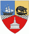
Currency / Language  
ISO Currency Symbol Significant figures
RON Romanian leu lei 2
Neighbourhood - Country  
  •  Bulgaria 
  •  Hungary 
  •  Moldova 
  •  Serbia 
  •  Ukraine