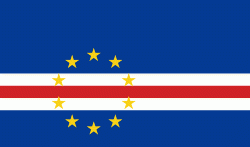
Cape Verde or Cabo Verde, officially the Republic of Cabo Verde, is an archipelago and island country in the central Atlantic Ocean, consisting of ten volcanic islands with a combined land area of about 4033 km2. These islands lie between 600 and 850 km west of Cap-Vert, the westernmost point of continental Africa. The Cape Verde islands form part of the Macaronesia ecoregion, along with the Azores, the Canary Islands, Madeira, and the Savage Isles.
The Cape Verde archipelago was uninhabited until the 15th century, when Portuguese explorers discovered and colonized the islands, thus establishing the first European settlement in the tropics. Because the Cape Verde islands were located in a convenient location to play a role in the Atlantic slave trade, Cape Verde became economically prosperous during the 16th and 17th centuries, attracting merchants, privateers, and pirates. It declined economically in the 19th century after the suppression of the Atlantic slave trade, and many of its inhabitants emigrated during that period. However, Cape Verde gradually recovered economically by becoming an important commercial center and useful stopover point along major shipping routes. In 1951, Cape Verde was incorporated as an overseas department of Portugal, but its inhabitants continued to campaign for independence, which they achieved in 1975.


