Barber (Barber)
Barber is a town in the north of the island of Curaçao. It is located inland from the north coast, to the southeast of Christoffelberg, at a major road junction. To the north lies the smaller settlement of San Hyronimo, and to the west lie Santa Cruz and Soto. The small settlement of Ascencion lies just to the east. In Barber there is a slavery museum and small nature park with the oldest tree in Curaçao.
Barber started as plantation Barber. The plantation was named after Barbara Exteen In 1827, a church was built on Barber. In 1832, the plantation was sold to the Roman Catholic Church. Barber quickly developed into the main town of the area. In 1913, the plantation was bought by the Government who divided the grounds into pieces of two hectares which people could rent.
Barber started as plantation Barber. The plantation was named after Barbara Exteen In 1827, a church was built on Barber. In 1832, the plantation was sold to the Roman Catholic Church. Barber quickly developed into the main town of the area. In 1913, the plantation was bought by the Government who divided the grounds into pieces of two hectares which people could rent.
Map - Barber (Barber)
Map


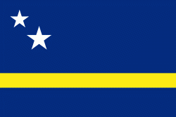
Country - Curaçao
 |
 |
Curaçao was formerly part of the Curaçao and Dependencies colony from 1815 to 1954 and later the Netherlands Antilles from 1954 to 2010, as Island Territory of Curaçao (Eilandgebied Curaçao, Teritorio Insular di Kòrsou), and is now formally called the Country of Curaçao. It includes the main island of Curaçao and the much smaller, uninhabited island of Klein Curaçao ("Little Curaçao"). Curaçao has a population of 158,665 (January 2019 est.), with an area of 444 km2; its capital is Willemstad.
Currency / Language
| ISO | Currency | Symbol | Significant figures |
|---|---|---|---|
| ANG | Netherlands Antillean guilder | Æ’ | 2 |
| ISO | Language |
|---|---|
| NL | Dutch language |