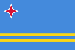
Aruba (Aruba Island)
Aruba, officially the Country of Aruba (Land Aruba; Pais Aruba) is a constituent country of the Kingdom of the Netherlands physically located in the mid-south of the Caribbean Sea, about 29 km north of the Venezuela peninsula of Paraguaná and 80 km northwest of Curaçao. It measures 32 km long from its northwestern to its southeastern end and 10 km across at its widest point. Together with Bonaire and Curaçao, Aruba forms a group referred to as the ABC islands. Collectively, these and the other three Dutch substantial islands in the Caribbean are often called the Dutch Caribbean, of which Aruba has about one-third of the population. In 1986, it became a constituent country within the Kingdom of the Netherlands, and acquired the formal name the Country of Aruba.
Aruba is one of the four countries that form the Kingdom of the Netherlands, along with the Netherlands, Curaçao, and Sint Maarten; the citizens of these countries are all Dutch nationals. Aruba has no administrative subdivisions, but, for census purposes, is divided into eight regions. Its capital is Oranjestad. Unlike much of the Caribbean region, Aruba has a dry climate and an arid, cactus-strewn landscape. The relatively warm and sunny weather, and the climate allow for related tourism activities all year round. Its area is 179 km2 and it is quite densely populated, with 108,166 inhabitants as at the 2020 Census.
The name Aruba most likely came from the Caquetio Oruba which means "Well situated island", seeing as it was the Caquetio who were present on the island when it was first set foot upon by Alonso de Ojeda. Between 1529 and the signing of the Treaty of Westphalia (1648), the name "Isla de Oruba" was used for the island by the Spanish. After the signing, the island was ceded to the Dutch and its name was changed to Aruba.
There were many different names for Aruba used by other Amerindian groups, all of which could have contributed to the present-day name Aruba. Another Caquetio name for the island was Oibubia which means "Guided island". The Taino name for the island was Arubeira. The Kalinago also had two names for the island Ora Oubao which means "Shell island" and Oirubae which means "Companion of Curaçao".
A common misconception is that the name Aruba came from the Spanish Oro hubo which means "There was gold". However the Spanish found no gold on Aruba during the time of their occupation, nicknaming Aruba and the rest of the ABC islands Islas Inútiles, meaning "Useless islands" due to the lack of gold. It was not until much later in 1824 that gold was found on Aruba by Willem Rasmijn, starting the Aruban Gold Rush. Another early Spanish name for Aruba was Isla de Brasil, named as such because of the many Brazilwood trees that grew on the island.
Map - Aruba (Aruba Island)
Map
Country - Aruba
 |
 |
Aruba is one of the four countries that form the Kingdom of the Netherlands, along with the Netherlands, Curaçao, and Sint Maarten; the citizens of these countries are all Dutch nationals. Aruba has no administrative subdivisions, but, for census purposes, is divided into eight regions. Its capital is Oranjestad. Unlike much of the Caribbean region, Aruba has a dry climate and an arid, cactus-strewn landscape. The relatively warm and sunny weather, and the climate allow for related tourism activities all year round. Its area is 179 km2 and it is quite densely populated, with 108,166 inhabitants per the 2020 census.
Currency / Language
| ISO | Currency | Symbol | Significant figures |
|---|---|---|---|
| AWG | Aruban florin | Æ’ | 2 |
| ISO | Language |
|---|---|
| NL | Dutch language |
| EN | English language |
| ES | Spanish language |


