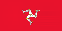
Andreas (Andreas)
Andreas ( or ; Skeerey Andreas) is one of the seventeen parishes of the Isle of Man. It is located in the north of the island (part of the traditional North Side division) in the sheading of Ayre. The main settlement in the parish in the village of Andreas, which is also known as Kirk Andreas.
There are several ancient monuments and sites located in the parish of Andreas. Ballavarry Burial Mound is a Bronze Age burial mound found a short distance outside of the village of Andreas.
Knock y Doonee is a significant historical and archaeological site in Andreas. Archaeological excavations on the area have uncovered a bilingual ogham stone in Latin and Ogham; a Christian keeill (a small chapel); a Christian carved stone cross; and a Viking Age boat burial.
Several carved stone crosses and slabs have been discovered in Andreas. Although many of the crosses are extant only as fragments and are located in the Manx Museum, Thorwald's Cross for example can be viewed at St Andrew's Church.
Several early Christian Manx keeills have been recorded throughout the parish although most have been destroyed when their remaining stones were removed for the construction of other buildings during the 19th century.
* Knock y Doonee keeill.
* Keeill Tushtag.
* Ballagonnell Keeill.
* Ardonan keeill.
Map - Andreas (Andreas)
Map
Country - Isle_of_Man
 |
 |
Humans have lived on the island since before 6500 BC. Gaelic cultural influence began in the 5th century AD, when Irish missionaries following the teaching of St. Patrick began settling the island, and the Manx language, a branch of the Goidelic languages, emerged. In 627, King Edwin of Northumbria conquered the Isle of Man along with most of Mercia. In the 9th century, Norsemen established the thalassocratic Kingdom of the Isles, which included the Isle of Man. Magnus III, King of Norway from 1093 to 1103, reigned as King of Mann and the Isles between 1099 and 1103.
Currency / Language
| ISO | Currency | Symbol | Significant figures |
|---|---|---|---|
| GBP | Pound sterling | £ | 2 |
| ISO | Language |
|---|---|
| EN | English language |
| GV | Manx language |


