'Amanave (‘Āmanave)
Amanave (Āmanave) is a village on the coast of Tutuila Island, American Samoa. It is located close to the island's western tip, Cape Taputapu, and to the south of the village of Poloa. It is located in Lealataua County.
Amanave was severely damaged by the 2009 tsunami. However, of a population of about 500 residents, no deaths were recorded. When the tsunami approached, emergency information was sent by radio and a bell rang in the village. After the tsunami, some residents followed the advice of the Federal Emergency Management Agency (FEMA) and moved into houses on a higher elevation.
Its mayor Aveao Faausu Fonoti received the Community Resiliency Leadership Award at the National Disaster Preparedness Training Center in 2010, due to his handling of the 2009 tsunami. The executive director of the center told reporters: "In spite of the fact that something like eighty percent of his village was destroyed, there were no casualties. And based on our research we found that many lives were saved because of his bravery, his leadership, his knowledge."
The village is in an area which is renowned for its rugged volcanic coastline. After its confluence with its tributaries near central parts of the village, Laloafu Stream discharges into the Pacific from Amanave Bay.
The first formal school established on the island was Atauloma Girls School in Amanave, which opened in 1900–1901. Although originally located in the village of Amanave, it was later relocated to Afao. Remains from the historic site can still be viewed on the top of the hill in the Atauloma area of Afao village.
During World War II, the single-lane roads which for long had been connecting Alofau in the east to Amanave in the west proved inadequate for military requirements. They were therefore replaced by a two-lane, coral-rock-surface road, which could handle the heavy military vehicles.
Map - 'Amanave (‘Āmanave)
Map
Country - American_Samoa
 |
 |
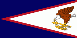
American Samoa consists of five main islands and two coral atolls; the largest and most populous island is Tutuila, with the Manuʻa Islands, Rose Atoll and Swains Island also included in the territory. All islands except for Swains Island are part of the Samoan Islands, The total land area is 199 sqkm, slightly more than Washington, D.C. As of 2022, the population of American Samoa is approximately 45,443 people, of whom the vast majority are indigenous ethnic Samoans. Most American Samoans are bilingual and can speak English and Samoan fluently.
Currency / Language
| ISO | Currency | Symbol | Significant figures |
|---|---|---|---|
| USD | United States dollar | $ | 2 |
| ISO | Language |
|---|---|
| EN | English language |
| SM | Samoan language |
| TO | Tongan language |


