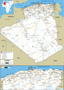
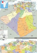
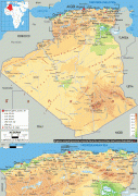
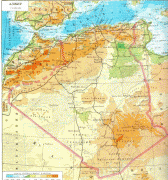
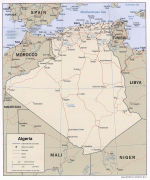
Algeria (People’s Democratic Republic of Algeria)
 |
|
| Flag of Algeria | |
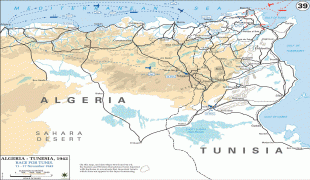
Algeria produced and is linked to many civilizations, empires and dynasties, including ancient Numidians, Phoenicians, Carthaginians, Romans, Vandals, Byzantines, Umayyads, Abbasids, Rustamids, Idrisids, Aghlabids, Fatimids, Zirids, Hammadids, Almoravids, Almohads, Zayyanids, Spaniards, Ottomans and the French colonial empire, with the latter expanded into its present-boundaries. After 132 years of being part of France, tensions between France and the local Algerian populace led to the start of the Algerian War which concluded with Algeria obtaining its independence on 5 July 1962 with the establishment of the People's Democratic Republic on 20 September of that year.
The official languages of Algeria are Arabic and Berber. The majority of Algeria's population is Arab, practicing Islam. The native Algerian Arabic is the main spoken language. French also serves as an administrative and educational language in some contexts, but it has no official status.
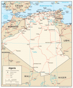
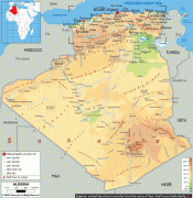
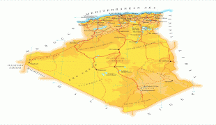
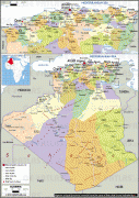
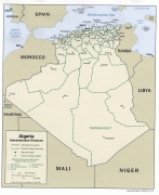
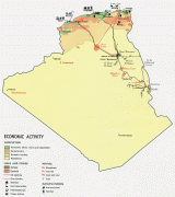
Algeria is a semi-presidential republic, with local constituencies consisting of 58 provinces and 1,541 communes. Algeria is a regional power in North Africa, and a middle power in global affairs. It has the highest Human Development Index of all non-island African countries and one of the largest economies on the continent, based largely on energy exports. Algeria has the world's sixteenth-largest oil reserves and the ninth-largest reserves of natural gas. Sonatrach, the national oil company, is the largest company in Africa, supplying large amounts of natural gas to Europe. Algeria's military is one of the largest in Africa, and has the largest defence budget on the continent. It is a member of the African Union, the Arab League, the OIC, OPEC, the United Nations, and the Arab Maghreb Union, of which it is a founding member.
Other forms of the name are: الجزائر, الدزاير; dzayer; ⴷⵣⴰⵢⴻⵔ; دزاير; Algérie. It is officially the People's Democratic Republic of Algeria (الجمهورية الجزائرية الديمقراطية الشعبية; Tagduda tamegdayt taɣerfant tazzayrit, ⵜⴰⴳⴷⵓⴷⴰ ⵜⴰⵎⴳⴷⴰⵢⵜ ⵜⴰⵖⵔⴼⴰⵏⵜ ⵜⴰⴷⵣⴰⵢⵔⵉⵢⵜ, تڨذوذا تازايريت تاماڨذايت تاغرفانت; République algérienne démocratique et populaire, abbreviated as RADP).
Currency / Language
| ISO | Currency | Symbol | Significant figures |
|---|---|---|---|
| DZD | Algerian dinar | دج | 2 |
| ISO | Language |
|---|---|
| AR | Arabic language |