Akkar District (Mohafazat Aakkâr)
Akkar District (قضاء عكار) is the only district in Akkar Governorate, Lebanon. It is coextensive with the governorate and covers an area of 788 km2. The UNHCR estimated the population of the district to be 389,899 in 2015, including 106,935 registered refugees of the Syrian Civil War and 19,404 Palestinian refugees. The capital is at Halba.
The district is characterized by the presence of a relatively large coastal plain, with high mountains to the east. The largest cities in Akkar are Halba, Bire Akkar and Al-Qoubaiyat.
Akkar has many important Roman and Arabic archaeological sites. One of the most famous archaeological sites and the birthplace of the Roman emperor Severus Alexander (d.235) is the Tell of Arqa near the town of Miniara. Several prehistoric sites were found in the Akkar plain foothills that were suggested to have been used by the Heavy Neolithic Qaraoun culture at the dawn of the Neolithic Revolution.
Akkar can be divided into 7 parts: Qaitea (القيطع), Jouma (الجومة), Dreib (الدريب), Jabal Akroum (جبل أكروم), Wadi Khaled (وادي خالد), Cheft (الشفت) and As-Sahel (السهل).
2021 Akkar explosion killed dozens of people.
Map - Akkar District (Mohafazat Aakkâr)
Map


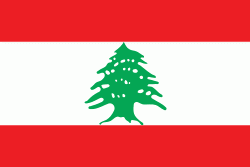
Country - Lebanon
 |
 |
| Flag of Lebanon | |
The earliest evidence of civilization in Lebanon dates back to 5,000 BCE. From c. 3200–539 BC, it was home to the flourishing Phoenician civilization before being annexed by various Near Eastern empires. In 64 BC, the Roman Empire conquered the region, and the region became a major center for Christianity under the Byzantine Empire. In the 7th century, the Muslim conquest of the Levant established caliphal rule. The 11th century saw the start of the Crusades and the establishment of Crusader States in the region only for it to be later reclaimed by the Ayyubids and Mamluks before being ceded to the Ottoman Empire in the 16th century. Under Sultan Abdulmejid I, the first Lebanese protostate took form in the 19th century as the Mount Lebanon Mutasarrifate, created as a home for the Maronite Christians under the Tanzimat reforms.
Currency / Language
| ISO | Currency | Symbol | Significant figures |
|---|---|---|---|
| LBP | Lebanese pound | لل | 2 |
| ISO | Language |
|---|---|
| AR | Arabic language |
| HY | Armenian language |
| EN | English language |
| FR | French language |