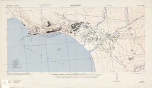
Agadir
 |
Agadir is one of the major urban centres of Morocco. The municipality of Agadir recorded a population of 924,000 in the 2014 Moroccan census. According to the 2004 census, there were 346,106 inhabitants in that year and the population of the Prefecture of Agadir-Ida Outanane was 487,954 inhabitants. The languages spoken in the city are Tashelhit (first language of the majority) and Moroccan Arabic.
It was the site of the 1911 Agadir Crisis that exposed tensions between France and Germany, foreshadowing World War I. The city was destroyed by an earthquake in 1960; it has been completely rebuilt with mandatory seismic standards. It is now the largest seaside resort in Morocco, where foreign tourists and many residents are attracted by an unusually mild year-round climate. Since 2010 it has been well served by low-cost flights and a motorway from Tangier.
The mild winter climate (January average midday temperature 20.5 °C/69 °F) and good beaches have made it a major "winter sun" destination for northern Europeans.
The name Agadir is a common Berber noun, meaning 'wall, enclosure, fortified building, citadel'. This noun is attested in most Berber languages. It may come from the Tuareg word aǧādir ('wall' or 'bank') or from Phoenician ('wall' or 'fortress'). The Phoenician etymology, if correct, would be the same as that of Cádiz in Spain.
There are many more towns in Morocco called Agadir. The city of Agadir's full name in Tashelhit is Agadir Ighir or Agadir-n-Irir, literally 'the fortress of the cape', referring to the nearby promontory named Cape Ighir on maps (a pleonastic name, literally 'Cape Cape').
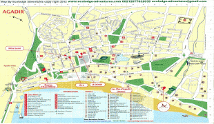
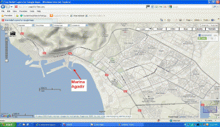
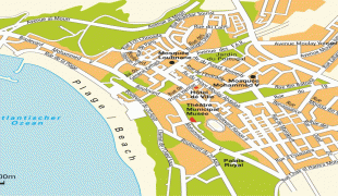
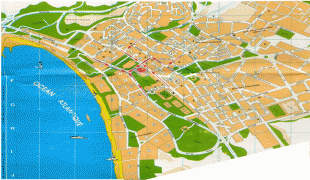
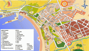
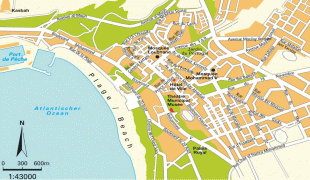
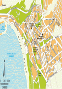
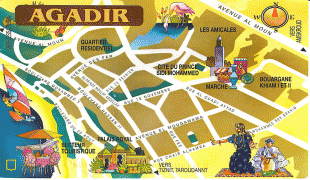
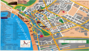
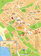
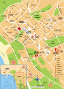
Map - Agadir
Map


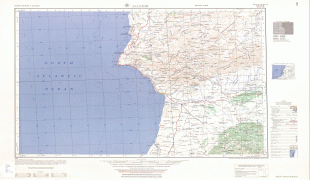


Country - Morocco
 |
 |
| Flag of Morocco | |
In a region inhabited since the Paleolithic era over 300,000 years ago, the first Moroccan state was established by Idris I in 788. It was subsequently ruled by a series of independent dynasties, reaching its zenith as a regional power in the 11th and 12th centuries, under the Almoravid and Almohad dynasties, when it controlled most of the Iberian Peninsula and the Maghreb. In the 15th and 16th centuries, Morocco faced external threats to its sovereignty, with Portugal seizing some territory and the Ottoman Empire encroaching from the east. The Marinid and Saadi dynasties otherwise resisted foreign domination, and Morocco was the only North African nation to escape Ottoman dominion. The 'Alawi dynasty, which rules the country to this day, seized power in 1631, and over the next two centuries expanded diplomatic and commercial relations with the Western world. Morocco's strategic location near the mouth of the Mediterranean drew renewed European interest; in 1912, France and Spain divided the country into respective protectorates, reserving an international zone in Tangier. Following intermittent riots and revolts against colonial rule, in 1956, Morocco regained its independence and reunified.
Currency / Language
| ISO | Currency | Symbol | Significant figures |
|---|---|---|---|
| MAD | Moroccan dirham | د م. | 2 |
| ISO | Language |
|---|---|
| AR | Arabic language |
| FR | French language |