Agadez Region (Agadez)
The region is a centre for palaeontology, with numerous dinosaur skeletons being found here, including the Ouranosaurus nigeriensis. Cave painting and the remains of ancient human settlements are also located here. Tuareg peoples began migrating to the region from the mid-8th century. From the mid-15th century to the early 20th, much of the region was under the control of the Sultanate of Agadez, except for a period when the area came under the rule of the Songhai Empire in the 1500s.
The region suffered with the advent of French colonialism as power shifted away to the southwest; Tuareg disaffection with French rule resulted in the Kaocen revolt in 1916–17. This process continued following Niger's independence in 1960; local Tuareg saw little recompense from the uranium mining boom in Arlit in the 1970s, and Agadez Region was struck by repeated droughts and famines. Since then there have been two Tuareg rebellions: from 1990–95 and 2007–09. In recent years the region has also been affected by an insurgency in the Maghreb by Islamist groups.
Map - Agadez Region (Agadez)
Map


Country - Niger
 |
 |
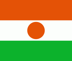
| Flag of Niger | |
It is one of the least developed countries and is also one of the poorest countries in the world by GDP per capita. Some non-desert portions of the country underwent periodic drought and desertification. The economy is concentrated around subsistence agriculture, with some export agriculture in the less arid south, and export of raw materials, including uranium ore. It faces challenges to development due to its landlocked position, desert terrain, low literacy rate, jihadist insurgencies and the world's highest fertility rates due to birth control not being used and the resulting rapid population growth.
Currency / Language
| ISO | Currency | Symbol | Significant figures |
|---|---|---|---|
| XOF | West African CFA franc | Fr | 0 |
| ISO | Language |
|---|---|
| FR | French language |
| HA | Hausa language |
| KR | Kanuri language |