Harita - Kurgantepe (Bokhtar)

Kurgantepe (Bokhtar)
Kurgantepe, resmi adıyla Bohtar, Tacikistan'ın güneybatısında bulunan Hatlon bölgesinin başkenti olan şehirdir. Güney Tacikistan'ın en büyük kenti olan Kurgantepe, ülkenin başkenti Duşanbe'nin 100 kilometre (62 mil) güneyinde ve Afganistan'ın Kunduz şehrinin 150 kilometre (93 mil) kuzeyinde yer almaktadır.

Şehrin Kurgantepe olan adı, Tacikistan yönetimi tarafından Türkçe olduğu gerekçesiyle değiştirildi. Yerine Fars kökenli Bohtar ismi seçildi.

 
Harita - Kurgantepe (Bokhtar)
Harita
Google Earth - Harita - Kurgantepe
Google Earth
Microsoft Bing - Harita - Kurgantepe
Microsoft Bing
OpenStreetMap - Harita - Kurgantepe
OpenStreetMap
Harita - Kurgantepe - Esri.WorldImagery
Esri.WorldImagery
Harita - Kurgantepe - Esri.WorldStreetMap
Esri.WorldStreetMap
Harita - Kurgantepe - OpenStreetMap.Mapnik
OpenStreetMap.Mapnik
Harita - Kurgantepe - OpenStreetMap.HOT
OpenStreetMap.HOT
Harita - Kurgantepe - OpenTopoMap
OpenTopoMap
Harita - Kurgantepe - CartoDB.Positron
CartoDB.Positron
Harita - Kurgantepe - CartoDB.Voyager
CartoDB.Voyager
Harita - Kurgantepe - OpenMapSurfer.Roads
OpenMapSurfer.Roads
Harita - Kurgantepe - Esri.WorldTopoMap
Esri.WorldTopoMap
Harita - Kurgantepe - Stamen.TonerLite
Stamen.TonerLite
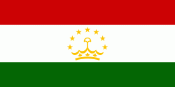
Ülke - Tacikistan
Döviz / Language  
ISO Döviz Sembol Significant Figures
TJS Somoni (Tajikistani somoni) ЅМ 2
ISO Language
TG Tacikçe (Tajik language)
Mahalle - Ülke  
  •  Afganistan 
  •  Kırgızistan 
  •  Çin 
  •  Özbekistan